
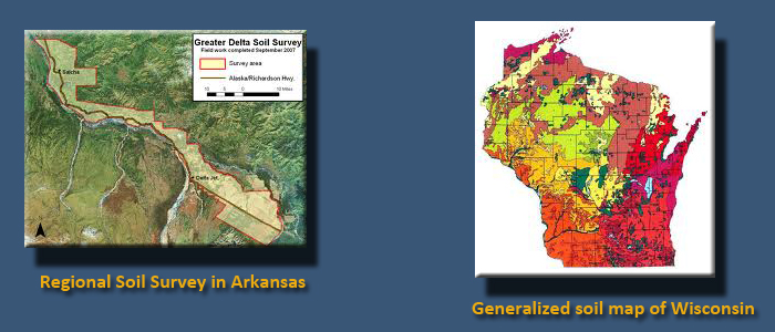
Soils
Soil type plays a significant part in the location of transmission lines. Soil stability is an important factor when locating transmission towers. Clearing of rights-of-way, especially on steep slopes, can expose soils and increase the chance of erosion. Slope failure, such as creeps, slides, and falls, can occur as a result of access road construction on unstable soils on steep hillsides. Soil compaction can result from the movement of heavy equipment along the right-of-way during construction, limiting the ability of the soil to be productive for forage or crops. Increased runoff can result in sediment loads that impact receiving streams. Where soils may be questionable for tower construction, additional engineering analysis must be done to find engineering solutions for tower placement and construction.
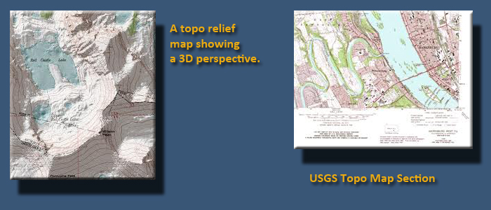
Topography
Topography is an important siting factor because it impacts environmental protection, construction activities, and ultimately, the transmission line cost. Construction of transmission lines on steeply sloped land creates added potential for soil erosion and sediment runoff, which then impacts receiving streams. Detailed engineered erosion and sediment control plans are developed to minimize environmental impacts. Construction on steep slopes presents many challenges: it affects the types of equipment used during construction, mobilization of this equipment, and how and where tower foundations are built. The erection and stringing of electric lines is more difficult on steep terrain than on flat terrain. Consequently, final project costs increase with an increase in slope.
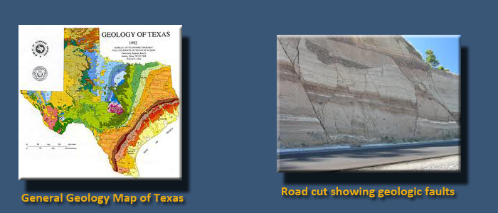
Geology
The type and extent of geologic features encountered along the proposed transmission corridor will impact decisions on siting. Geologic fault zones, seismic zones, rock type and extent (an example would be limestone and associated solution channels) pose both environmental concerns and construction concerns. Disturbance of acid rock can create a source of water pollution that could impact receiving streams. Towers constructed in geologic fault zones or seismic zones require detailed engineering analysis and enhanced construction methods.
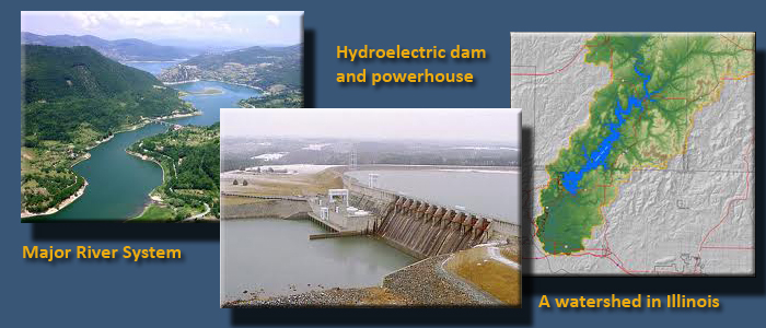
Water
Water resources can be impacted by construction activities associated with new transmission lines, or with the upgrading of existing transmission lines. Removal or disturbance of vegetation, resulting from the clearing of right-of-way corridors, may affect the natural hydrology of a watershed by altering surface runoff and stream flows. This may lead to decline in water quality by increasing sediment and chemical pollutant loads and warm water inputs. Access roads have the potential to impact water resources by altering natural stream hydrology. Removal of stream shade cover resulting in warmer water could impact aquatic species, especially in cold-water streams. Herbicides used to maintain right-of-way can enter streams through runoff from impacted soils. The siting process should quantify the number of stream crossings and minimize the number of streams and rivers to be crossed by the transmission corridor.
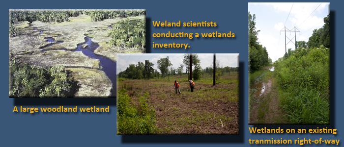
Wetlands
Generally, wetlands are lands where saturation with water is the dominant factor determining the nature of soil development and the types of plant and animal communities living in the soil and on its surface. Wetland functions include water quality improvements, water storage, water filtration, and biological productivity. According to the U.S. Environmental Protection Agency:
- An acre of wetland can store 1 to 1.5 million gallons of floodwater.
- Up to one-half of North American bird species nest or feed in wetlands.
- Wetlands occupy about 5% of the land surface in the mainland U.S., and they are home to 31% of the plant species.
- 75% of commercially harvested fish are wetland-dependent.
Wetlands vary widely because of regional and local differences in soils, topography, climate, hydrology, water chemistry, vegetation, and other factors, including human disturbance. For regulatory purposes under the Clean Water Act, the term "wetlands" means "those areas that are inundated or saturated by surface or groundwater at a frequency and duration sufficient to support, and that under normal circumstances do support, a prevalence of vegetation typically adapted for life in saturated soil conditions. Wetlands generally include swamps, marshes, bogs and similar areas."
The siting process for wetlands is usually a two-step process. During the initial stage of siting, the National Wetlands Inventory is a resource used to identify wetlands in the proposed transmission line corridors. Once these wetlands have been mapped, they must be verified through field identification of plants and soils using methodology outlined in the 1987 Wetland Delineation Manual. The intent of the siting process is to minimize the impact on surveyed wetlands.
Some of you may remember the Great Flood of 1993 on the Mississippi River. It created billions of dollars in economic loss, not to mention the devastation to homes and communities along its path. You also remember Hurricane Katrina and the horrific impact it had on New Orleans. In 2011, we saw the same scenario played out again with the flooding of the Mississippi River. Each of these disasters can be contributed in some part to the loss of valuable wetlands. The Upper Mississippi River Basin has lost a significant amount of wetlands that historically provided storage and buffering from significant rain events. As for Katrina, the wetlands delta buffering New Orleans from ocean surges has also diminished in size over the years, reducing the protection from hurricanes the city once had. I'm sure many of you are aware of impacts on smaller scales in watersheds close to where you live. So, the message is: wetlands are important not only to protect our economy, but also because they play a part in minimizing impacts on individuals, families, communities, and ecology.
Reading assignment
- Go to the EPA Wetlands Fact Sheet Series.
- Under the "Introduction to Wetland" heading, click on and read the following:
- Wetlands Overview
- Types of Wetlands
- Functions and Values of Wetlands
- Economic Benefits of Wetlands
- Threats to Wetlands
- Wetlands: Protecting Life and Property from Flooding
- Under the "Regulatory Under the Clean Water Acet, Section 404", Click on and read the following:
- Wetland Regulatory Authority
- How Wetlands are Defined and Identified
- Wetlands Enforcement
- After reading the materials listed above, you should be able to answer the following questions:
- What is the regulatory act that authorizes wetland protection in the United States?
- What government agency is responsible for the enforcement of wetland regulations in the United States?
- What role does the U.S. Environmental Protection Agency play in wetlands protection?
- What is the official definition of wetlands?
- When is a Section 404 permit required?
- What are the four general categories of wetlands found in the United States?
- What are the three major functions of wetlands?
- How do wetlands control runoff and flooding?
- The 1993 and 2011 flooding of the Mississippi River caused significant economic damage in the billions of dollars. A significant contributor to this damage has been the destruction of wetlands in the Upper Mississippi River Basin. How many acres of wetlands have been lost in this upper basin since the 1890s?
- It is estimated the United States had over 220 million acres of wetlands in the 1600s. Today that number is around 100 million acres due to wetlands being converted for other uses. What is the annual rate of wetland loss in the United States?
Want to learn more?
A detailed, technical explanation can be found in the 1987 U.S. Army Corps of Engineers Wetland Delineation Manual.
Watch this!
The following 4:10 minute video tells a story of sacred Indian wetlands in Kansas and the proposed construction of a highway corridor adjacent to it. It shows how a lack of due diligence in the siting process created public relations problems. Similar situations can occur when siting any energy generation facility or transmission line. You may encounter a message that says "The video contains content from EMI. It is restricted from playback on certain sites." If so, watch on YouTube.
Haskell University Used to be Haskell Institute
An institution where children were taken from their families and beaten or thrown in the Haskell jail for speaking their own language. It is believed in an effort to keep official death rates down, students were buried in the wetlands just south of the Institute. It is also believed that students close to death, refusing to die within Haskell’s walls wandered out to these same wetlands as their place of passing. In an odd twist of irony, these wetlands today are used by the students and faculty to practice traditional Native American religions once banned by the institution. The wetlands are not only a refuge for students and faculty but also a wildlife refuge and sanctuary. Now the State of Kansas wants to put a highway right through its heart.
In 1992 The US Army Corps of Engineers sends out public notices soliciting comments about plans to mitigate the 31st Street wetlands in the path of the traffic way. Douglas County fails to include Haskell on the mailing list. Four individuals and a few agencies respond by the January 18th deadline. The Corps approves the permit without further public hearings.
In 1994 the Lawrence Chamber of Commerce has a groundbreaking ceremony for the western nine miles of the traffic way.
In 1998 in response to a lawsuit by American Indians and environmentalists, a federal judge halts work on the project until an impact statement is completed.
In 2000, the final supplemental environmental impact is released to the public. The 5-inch thick document includes the words…No Build
In April 2011 kdot Chief Council Mike Rees makes public his effort for a 32nd Street route for the traffic was that would move the project off Haskell property.
After many years of study, the Corps announced in January 2004 that it had determined that a 32nd Street route was the “least environmentally damaging practicable alternative.
But now, the Potawatomi Nation has proposed a new route that would run south of the Wakarusa River. The Potawatomi route would be considerably less expensive than the Corps route. We have a responsibility to respect cultural and religious viability. A responsibility to know the environmental and cultural wealth we are losing at the cost of “progress”. Save the Haskell & Baker Wetlands.