
Non-structural Mitigation
Warning Systems and Community Education
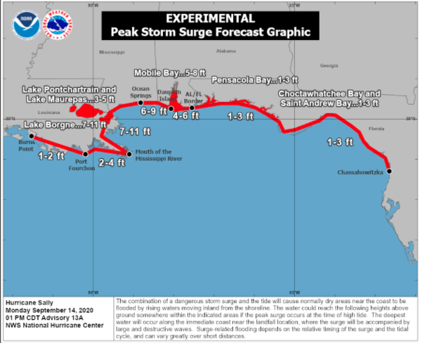
Developing effective warning systems is an essential non-structural mitigation activity. Hurricane forecasts typically provide a few days’ advance notice of the potential for a hurricane affecting a particular area; While not perfect, storm surge forecasts can provide enough time for emergency managers to issue warnings. After Superstorm Sandy, a storm surge warning system was developed for the Meadowlands District in New Jersey that can provide storm surge forecast maps at least three hours in advance. When a hurricane is approaching the shoreline of the U.S. the National Hurricane Center issues regular advisories which give graphic information about storm surge, as well as estimates of the height of the storm surge for an area (form of estimates for certain stretches of coastline). Local authorities can take this information and use it to warn residents, for example, if a certain roadway is likely to flood, or if a levee is likely to be topped. Each storm is unique and, due to the many factors driving the impacts in a particular location (say, your house), storm surge forecasting is still tricky to predict on a small scale, especially because it is affected by even small changes in the landfall location as was the case in Hurricane Laura in August 2020. On a neighborhood or larger scale, the National Storm Surge Hazard Maps provide an interactive mapping tool to estimate storm surge based on the hurricane category on the Saffir-Simpson Scale.
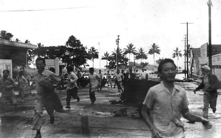
Establishing detection and warning systems are particularly essential to tsunami policy, as we have mentioned in previous modules. After a 1946 tsunami killed 160 people in Hilo, Hawaii, and 5 in Alaska, the United States established its first tsunami warning center in Ewa Beach, Hawaii. This center, now known as the Pacific Tsunami Warning Center (PTWC), is responsible for issuing most tsunami warnings for areas bordering the Pacific Ocean. A center in Palmer, Alaska, currently known as the National Tsunami Warning Center, provides warnings for Alaska, the Pacific coast of Canada, and the Pacific coast of the continental United States.
Following the 2004 Indian Ocean tsunami, which cost hundreds of thousands of people their lives, the United States spearheaded an effort to establish regional warning systems worldwide for coastal regions vulnerable to tsunamis. Initial responsibility for managing the Indian Ocean and Caribbean Sea systems fell to the PTWC, but the Indian Ocean system is now administered by national government organizations in Australia, India, and Indonesia, while a Caribbean Sea center opens in Puerto Rico in early 2021. Together with the North Atlantic and Mediterranean Tsunami Warning System, a European partnership, these organizations provide critical early warnings for tsunami events that serve an important preparedness function for regions exposed to tsunamis. See more details about the Global Tsunami Warning and Mitigation System in the Banda Aceh Case Study in this module.
In addition to having a sophisticated warning system in place and multiple ways to communicate warnings to residents, including phone texts, email, local TV news, as well as announcements via other broadcasting methods such as mosque loudspeakers in Islamic communities, and community group messenger networks, public education about what to do when an alert is broadcast is essential. This need is articulated in the case study in this module on the 2004 Indian Ocean tsunami and its impacts in Banda Aceh, Indonesia.
Other Non-Structural Mitigation Activities
Post-Disaster Recovery Plan
After disasters occur, the recovery process can be complex and overwhelming, so a post-disaster recovery plan is another helpful non-structural mitigation measure put in place by community-level government agencies. There are many aspects of recovery – economic, housing, environment, and social recovery – that should be considered. There are also many stakeholders who need to be involved in the recovery process. Developing a post-disaster recovery plan can identify and prioritize tasks and can recognize and engage stakeholders before an event takes place, thereby assisting recovery and minimizing chaos during a stressful time.
Zoning
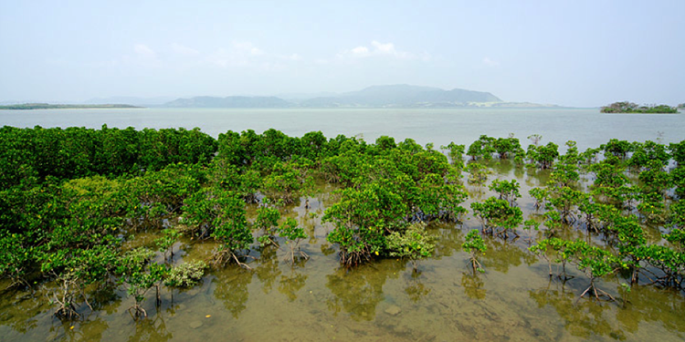
Another non-structural mitigation measure is zoning. Zoning enables local or regional governments to set restrictions on the types of structures that can be built in various locations within their jurisdictions. This tool can be used to prevent critical infrastructures such as power plants and hospitals from being built in tsunami or storm surge inundation risk zones. It can also be used in conjunction with development restrictions to prevent projects that would damage natural habitats, such as mangroves, that can mitigate tsunami or hurricane damage.
Education and Outreach
As we noted above, educating the public about mitigation measures are essential so that residents know what they can do to protect themselves, their families, and their property. So, education about tsunami and storm surge planning can fall under mitigation, but it is also part of preparedness.