
Reading Assignment
- SECS, Chapter 5: Meteorology, section dealing with The Role of Clouds
- [supplemental] Meteorology for Scientists and Engineers, 2nd ed. by Roland B. Stull (Chapter 7). Available under the Modules tab in Canvas in Lesson 3.
Clouds are the big challenge in solar resource assessment. Think about how we just established a "clear sky" model, but most of our skies are filled with clouds that are dynamic and diverse in character. What is it about clouds that makes resource assessment challenging? Take a moment now to familiarize yourself with cloud phenomena and types.
Clouds: the major factor influencing intermittency
Clouds are emergent phenomena within the atmosphere, and strongly perturb the behavior of the solar resource in a given locale. When we do not have a clear sky day in our locale (typical in many locations on Earth), the effects of clouds will strongly draw down the beam component of our solar resource and increase the net fraction of diffuse sky irradiance.
Clouds can develop in environments that are termed active and passive, as well as from updrafts near the Earth’s surface. As we have seen in the reading, clouds have the ability to either scatter and reduce incident light, or to act as a lens at the perimeter, focusing light well above clear sky or even AM0 irradiance conditions.
From the perspective of an observer standing on the Earth's surface, clouds can be classified by their physical appearance. Accordingly, there are essentially three basic cloud types:
- Cirrus, which is synonymous with a "streak cloud" (detached filaments of clouds that literally streak across the blue sky),
- Stratus, which, derived from Latin, translates to a "layered cloud," and
- Cumulus, which means "heap cloud."
Let's review some basic types of clouds. Please do comparative reading between the figure below (with images) and your list of cumuliform, stratocumulus, and stratiform clouds in Ch. 5 of SECS.
-
Cirrus (Ci): Clouds characterized by thin, wispy strands, forming in either patches or streaks. No uniformity (either in clumps or layers) in such clouds are usually observed. Cloud edges are not distinct and there is generally no shading of cloud elements.
-
Cirrocumulus (Cc): High cloud composed of very small but distinct cloud elements. Elements may in turn be arranged in patches or waves. Individual cloud elements are uniform in appearance and show no shading (and may appear at times to be translucent).
-
Cirrostratus (Cs): High, thin, generally uniform sheets of clouds formed by ice crystals. Sun/moon is brilliantly observed through the clouds which often produced optical phenomenon such as halos.
-
Altocumulus (Ac): Mid-level cloud consisting of globular masses or rolls in layers, lines, or patches. Individual cloud elements are usually white or gray with a minimal amount shading. Cloud edges are distinct due to their composition of water droplets.
-
Altostratus (As): Mid-level cloud of uniform density displaying no distinct features over the entire layer. Sun can usually be observed, but is often quite dim and does not display any optical phenomenon.
-
Cumulus (Cu): Low-level convective cloud with flat bases and distinct outlines. Fair weather cumulus exhibit only slight vertical growth, with the cloud tops designating the limit of the rising air.
-
Cumulus-congestus (TCu): Vertically developed clouds that are usually twice as tall as they are wide. Clouds exhibit hard, distinct boundaries along their top edges, lacking a fibrous anvil.
-
Cumulonimbus (Cb): A towering, vertically developed cloud occurring individually, in clusters, or lines. Clouds display a characteristic anvil at it's top and are most often accompanied by rain, gusty winds, and (occasionally) hail.
-
Stratocumulus (Sc): A layer of cloud consisting of large dark, rounded masses, usually in groups, lines or waves. Cloud bases can be quite low, but individual cloud elements are fairly shallow in vertical development. Little, if no, precipitation is observed from such clouds.
-
Stratus (St): Low, gray, uniform clouds usually covering the entire sky and persisting for an appreciable period of time. Clouds may produce some intermittent drizzle or snow flurries but are not characterized by persistent or significant precipitation.
-
Nimbostratus (Ns): Low, gray, uniform clouds usually covering the entire sky and persisting for an appreciable period of time. Characterized by constant rain or snow of light to moderate intensity.
Clouds are listed here with images that pop up when you click on the red dots. We see variants of cumuliform clouds, stratocumulus clouds, and stratiform clouds, as noted in our reading.
There are four general classifications of clouds: high, middle, and low clouds as well as clouds of vertical development. The table below summarizes each of these classifications while giving you a sense for the typical altitudes at which their cloud ceilings (the height of their bases) are observed, and the basic chemistry of the clouds (ice and water interact with light in different ways).
| Type of Cloud | Definition | Image |
|---|---|---|
| High Clouds | Observed over the middle latitudes. Typically reside at altitudes near and above 20,000 feet. At such rarefied altitudes, high clouds are composed of ice crystals. | 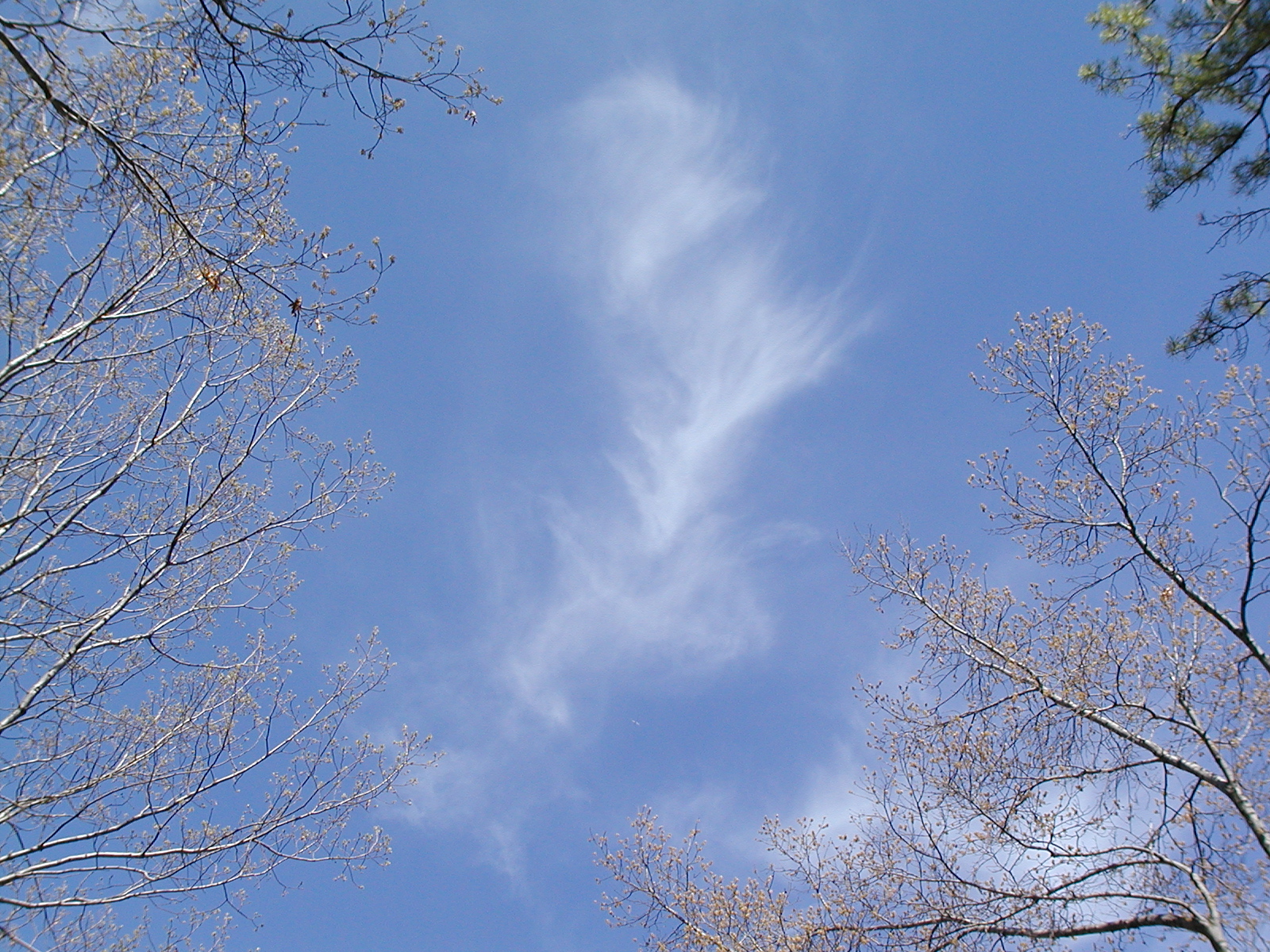 |
| Middle Clouds | Reside at an average altitude of ~10,000 feet over the middle altitudes. Keep in mind that this is an average altitude, so middle clouds can form a couple of thousand feet above or below the 10,000 foot marker. Middle clouds are composed of water droplets and/or ice crystals. | 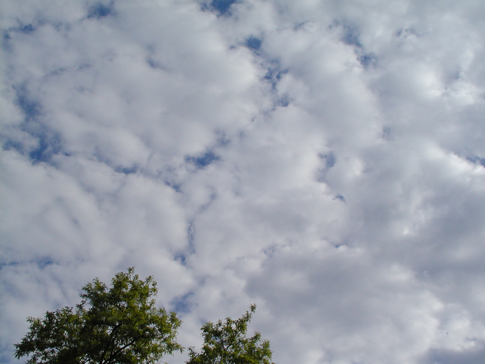 |
| Low Clouds | Can form anywhere from the ground to an altitude of approximately 6000 feet. For the record, fog is simply a low cloud in contact with the earth's surface. |  |
| Clouds of vertical development | Cannot be classified as high, middle, or low because they typically occupy more than one of the above three altitude markers. For example, the base of a tall cumulonimbus cloud often forms below 6000 feet and then builds upward to an altitude far above 20,000 feet. | 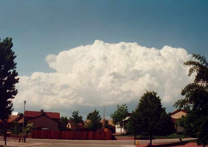 |
Recapping: You should begin to think about how clouds can both block the beam component of light from the Sun (making the skydome more diffuse in nature), and can refract and scatter light like a lens, increasing the irradiance on a locale far higher than predicted from a clear sky model.
- Blocking beam irradiance
- Enhancing beam irradiance through "lensing" over a local site (effects can last several minutes locally)
Researchers are now trying to predict cloud behavior with respect to GHI and DNI variation in a given locale. We are still a few years off, but soon we may see solar forecasts that include cloud interference for solar resource assessment.
Acknowledgment: Content of this page comes from Meteo 101: Understanding Weather Forecasting; author: Lee Grenci and David Babb.