
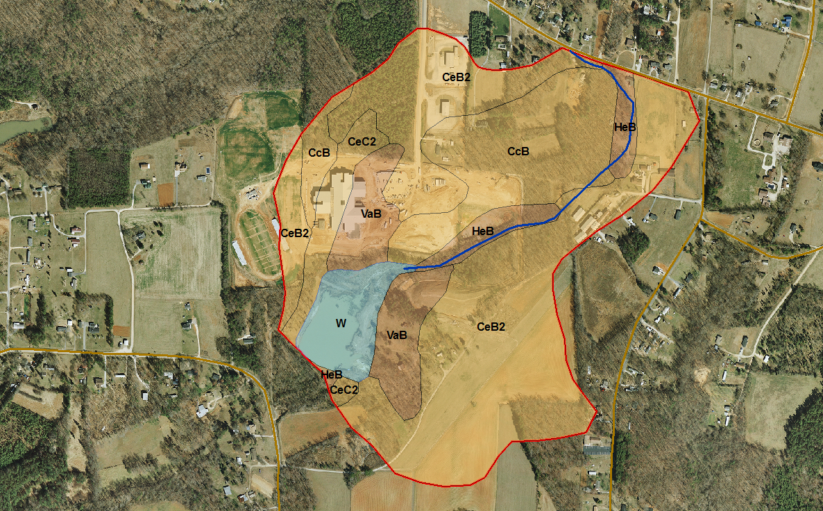
Figure 8.1: Here is an example of how soils data is displayed and used. In this application, soils data was combined with landuse data to determine runoff coefficients for use in estimating runoff to streams during rainfall events.
Credit: Ron Santini
Why we need it
Soils information plays an important role in both the engineering and the environmental aspects of siting. From an engineering perspective, soils data provides information about soil stability, depth to groundwater, depth to bedrock, and other characteristics that impact the construction of transmission towers. From an environmental perspective, soils information provides information about runoff and erosion potential, wetlands, and groundwater.
Where to find it
- The Natural Resources Conservation Service at the United States Department of Agriculture maintains soils surveys for most every county in the United States. In addition, the local county agriculture extension office also has this information available in both digital and hard copy form.
- State and local soils data can be searched and downloaded from the U.S. Department of Agriculture Geospatial Data Gateway. Click on the big green GET DATA button at the top center of the page. You will be directed to the soil data mart to select a state you are interested in.
Tell us about it!
Do you have a suggestion or two for additional data sources? Do you know of any international sources? Use the Discussion Forum to share your suggestions with the class!