
Why we need it
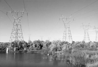
The impact on water quality from siting corridors is a major concern during construction, and identifying streams and wetlands to be crossed or encroached on during construction is a an important factor in siting decisions. The location of wild and scenic rivers, special stream designations, such as cold water fisheries or trout streams, or impaired streams may require additional permitting during the planning phase of siting and increased monitoring during and after the construction phase. The location of waters used as sources for public drinking water may require additional erosion and sedimentation control permitting and monitoring. The construction of power lines through wetlands or constructing road crossings through wetlands requires a wetlands identification and assessment, and a permit issued by the US Army Corps of Engineers. The permit will outline the mitigation steps to minimize the impact to the wetland.
Where to find it
- The National Hydrography Dataset (NHD) is the surface water component of The National Map. The NHD is a digital vector dataset used by geographic information systems (GIS). It contains features such as lakes, ponds, streams, rivers, canals, dams, and stream gauges. These data are designed to be used in general mapping and in the analysis of surface-water systems.
- The United States Environmental Protection Agency (USEPA) US waters. Watershed Assessment, Tracking & Environmental ResultS (WATERS) is an integrated information system for the nation's surface waters. The EPA Office of Water manages numerous programs in support of the Agency's water quality efforts. Many of these programs collect and store water quality related data in databases.
- USEPA's Surf Your Watershed provides data about individual watersheds and links to the USEPA's Envirofacts Warehouse where additional data for water, waste, air, land, toxins, compliance, radiation, and other data can be accessed and downloaded.
- The United States Geological Survey collects water resources data from approximately 1.5 million sites throughout the United States, the District of Columbia, Puerto Rico, the Virgin Islands, Guam, American Samoa, and the Northern Mariana Islands. Real-time information about surface water, groundwater, and water quality can be accessed and retrieved through the National Water Information System.
- National Oceanic and Atmospheric Administration's Hydrometeorological Design Studies Center contains precipitation data, links to watershed and stream-flow data, and maps and aerial photographs.
- The CUAHSI Hydrologic Information System is an Internet-based system for sharing hydrologia data. It is comprised of databases and servers connected through Web services to client application that allow for the discovery, access, and publication of hydrologic data.
- Wetlands data can be accessed through the U.S. Fish & Wildlife Service's National Wetlands Inventory. This service has developed a series of topical maps to show wetlands and deep-water habitats. This geospatial information is used by federal, state, and local agencies, academic institutions, and private industry, for management, research, policy development, education, and planning activities.
Tell us about it!
Do you have a suggestion or two for additional data sources? Do you know of any international sources? Use the Discussion Forum to share your suggestions with the class!