The Future
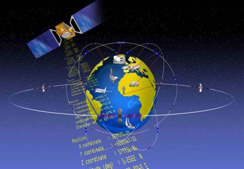
So, what is coming? Someday, there may be as many as 130 navigation satellites aloft. They will be from GPS, GLONASS, Galileo, BeiDou, QZSS, IRNSS, and perhaps others. If so, the systems will provide users with quite a variety of signals and codes. The availability of many more satellites will enable new applications in areas where their scarcity has been a hindrance. For civil users, new signals will provide more protection from interference, ability to compensate for ionospheric delays with pseudoranges, and wide-laning or even tri-laning capabilities. For military users, there will be greater anti-jam capability and security. For everybody, there will be improvement in accuracy, availability, integrity, and reliability. So, it is no surprise that there is great anticipation from a business perspective, but from a user’s point of view, the situation is not unlike the advent of GPS years ago. Much is promised, but little assured. New capabilities will be available, but exactly what and exactly when is by no means certain.
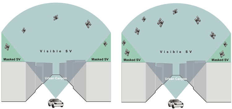
More satellites will be above an observer’s horizon. GPS and GLONASS together now provide the user with ~2 times the satellites than does GPS alone. If GPS, GLONASS, and Galileo are considered together, there will be ~3 times more. If BeiDou is added to the mix, there will be ~4 times more satellites that will be available to a user. In a sense, the more satellites, the better the performance, particularly among trees and in urban canyons, those places where signals bounce and scatter, and multipath abounds. For example, with the 6 satellites in a window available to a GPS receiver on the left side of the Urban Canyon figure below, the user may be able to increase the mask angle to decrease the multipath and still have 4 satellites to observe. Imagine if there were 12, 18, or even 24 satellites in the picture, and you can see how more satellites can mean better accessibility in restricted environments.
More satellites also mean more measurements in shorter time and that means observation periods can be shortened without degrading accuracy, in part because interference can be ameliorated more easily. With more satellites available, the time to first fix for carrier-phase receivers, the period when the receiver is solving for the integers, downloading the almanac and so forth, also known as initialization, will be shortened significantly. And fixed solution accuracy will be achieved more quickly. Today, dual-frequency carrier-phase solutions are accurate but noisy; but with the new signals available on L2C, L5, and other GNSS signals, dual-frequency solutions will be directly enhanced. While a GNSS capable receiver may offer a user improved availability and reliability, it may not necessarily offer higher accuracy than is available from GPS. However, the achievement of high accuracy more conveniently and in more places— that seems to be within reach with GNSS. It also means better ionospheric correction. Remember, the ionospheric delay is frequency dependent.
The algorithms currently necessary for the achievement of high accuracy with carrier-phase ranging may be simplified, since many of the new GNSS signals will be carrying a civilian code. Generally speaking, code correlation is a more straightforward problem than is carrier differencing. This may lead to less complicated receivers. This presents the possibility that they will be less expensive.
Also, the more diverse the maintenance of the components of GNSS, the less chance of overall system failure; the United States, Russia, the European Union, and China all have infrastructure in place to support their contribution to GNSS. Under such circumstances, simultaneous outages across the entire GNSS constellation are extremely unlikely.