
Mekong Delta - Floating Communities
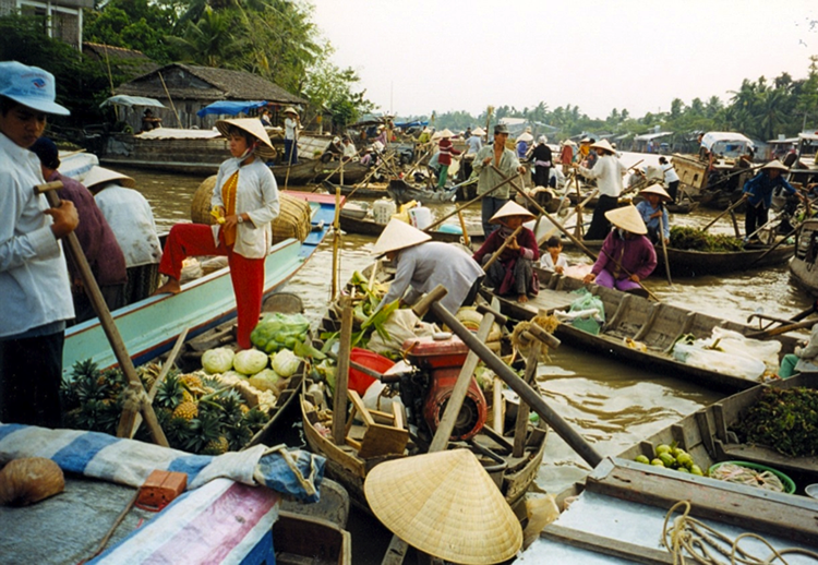
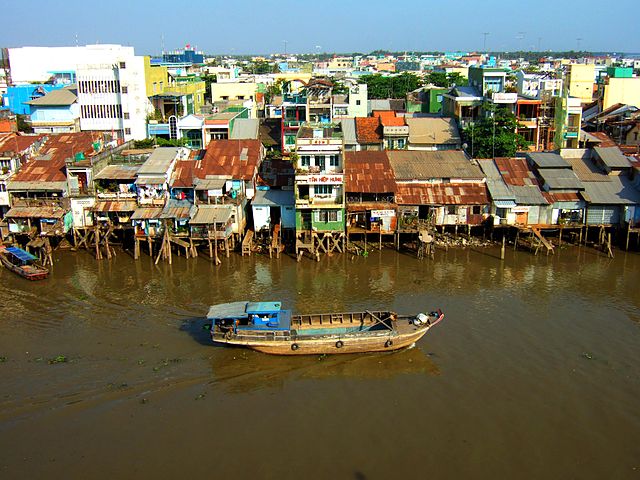
The Mekong Delta in Southern Vietnam is characterized by a vast and fertile flood plain, made possible by the presence of delta distributaries, canal networks, and small villages and houses, an important corridor for biodiversity. The region's tropical climate, with a wet season lasting most of the year, calls for adaptation to the ever-flowing waters of the region. The fertile soils and lack of topographic relief in the lower delta and coastal zone compared to the proximal areas with more relief, produced two distinct types of communities. In the upstream delta regions with more topographic relief, communities are organized into villages with a typical cluster of housing or buildings, while, in the lower delta, communities are not organized into villages. Instead, they are spread throughout the delta, lining the channel banks and waterways that run through the district. This primitive smart building suggests that perhaps the floating or elevated houses are near canals to make more space available for agriculture, but also to provide access to transportation. The canals are the main routes for transport in and out of the district, with boats being the main form of transportation for both people and goods. Secondary transportation routes include elevated narrow roadways that run between rice fields, connected through centralized hubs where pedestrians and bikes can be transported across canals by ferries.
Despite the adaptation of communities to living with water in the Mekong delta, climate change-driven sea level rise, drought, and river floods remain a threat. The Vietnam Ministry of Natural Resources and Environment predicted in 2012 that a 1 m increase in sea level would inundate approximately 39% of the lower Mekong delta basin. The risk to these communities might be even higher if one considers droughts and floods inundating agricultural land, damaging crops, and potentially disrupting the food supply. As a result, the Asian Management and Development Institute is working with coastal provinces of the Mekong on community adaptation programs to better understand and prioritize climate risks and take actions to strengthen their resilience to food and livelihood insecurity resulting from climate change. The adaptation is needed to ensure key income continuity, sustenance food sources generated through rice production, aquaculture (shrimp and clam), livestock rearing (ducks and pigs), and coastal shellfish farming.