
Educating the Public about Tsunami and Storm Surge Preparedness and Warning Systems
Educating the public about the existence of warning systems, how they work, and how to react when it is activated are essential components of the preparation.
Tsunami Warning and Public Readiness
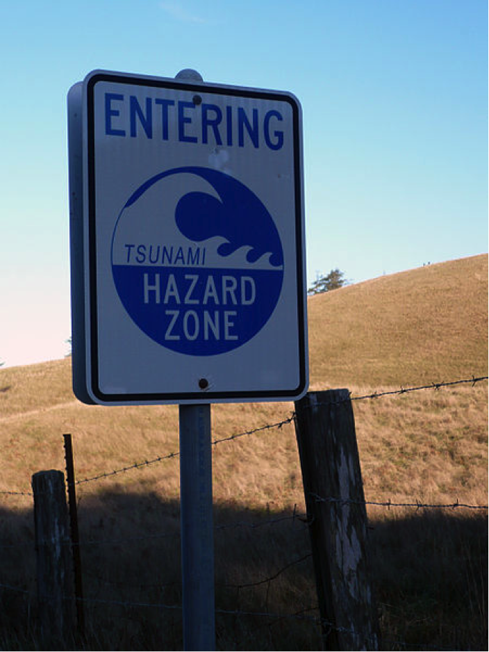
In the parts of the United States' most vulnerable to tsunamis – that is, the coastal zones of Hawaii, Alaska, Washington, Oregon, and California – this primarily takes the form of evacuation planning. Anyone driving through low-lying coastal areas of these states is likely to notice tsunami hazard zone and tsunami evacuation route signs lining the roads, and warning signs in beachside hotels and motels.
The National Weather Service’s Tsunami Ready website provides a wealth of guidance for the public about what readiness for a tsunami involves and how to achieve it. Communities can organize tsunami ready training through the NWS program with the goal of achieving community-wide tsunami readiness.
Residents and visitors on the Oregon coast have several location-specific tools to use to learn about tsunami risk in their area and to receive messages about tsunami threats. The State of Oregon Department of Geology and Mineral Resources Oregon Tsunami Clearinghouse is a web site where you can go to get detailed evacuation maps, smartphone apps to aid evacuation, and an interactive evacuation zone map viewer at NVS Tsunami Evacuation Zones.
Learning Check Point
Hurricane Storm Surge Warnings and Public Readiness
When a hurricane is approaching the United States and threatens to make landfall, Emergency Operation Plans go into action in the areas likely to be affected. As we mentioned above in the mitigation section, forecasting local storm surge levels can be challenging as it depends on several factors, including the track of the storm, exact landfall location, the timing of the tide cycle, water depth, and the angle and slope of the shoreline, complicating accurate predictions. This, in turn, affects preparation communication.
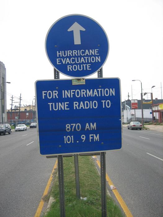
Therefore, hurricane preparation in a community that may receive a storm surge must start well before the magnitude of the threat is certain for that location. Evacuation orders should be made 72 hours in advance of a storm’s landfall. Many mandatory evacuations have been communicated to the public, only to see the path of the hurricane turn elsewhere. This means that city or county leaders must decide several days out to close schools and businesses, mobilize transportation for those without, prepare shelters, etc. Additionally, all communities within the “cone of uncertainty” of forecast tracks based on modeling, must be on alert and be making preparations. A storm’s track can change significantly during the approach, depending on the steering factors. Hurricane Sally in September 2020 is a good example. Greater New Orleans and Southeastern Louisiana were under a hurricane warning and evacuations and preparation well underway but within 36 hours of landfall, the track moved significantly to the east, so that Mississippi, Alabama, and western Florida received the brunt of the storm surge effects and hurricane warnings were downgraded to tropical storm warnings in New Orleans. Residents of the storm-aware Gulf coast must stay vigilant for these kinds of changes in the forecast.
On a family level, preparedness begins with making a hurricane supply kit (see below) and making a plan for the event of a hurricane. Within 72 hours of landfall, multitudes of decisions must be made, and actions taken. A very abbreviated list of things to be considered in a coastal community threatened by storm surge is: Securing or moving all moveable/ floatable items to a safe place; Securing boats in dock; fueling and moving vehicles, boats, trailers, etc. out of harm’s way; securing the house, by boarding up windows or closing hurricane shutters, and turning off water and power; planning evacuation route and accommodation while away; and communicating with neighbors and family members to ensure everyone has a way to evacuate and a place to go.
Information driving preparedness is broadcast in many ways. A resident in a storm surge zone can best track the storm via local TV news stations and weathercasts to find details about the storm’s impacts in their community. These are often pushed as notifications to mobile devices. The National Hurricane Center provides many kinds of useful graphics that are updated every 4 hours. Mobile Apps are available to access this information too.