
Sediment Supply
How is sediment supply related to the tectonic setting of a coastal zone?
The availability and transport of sediment, loose non-cohesive material, within the coastal zone strongly affect the morphology of a coastal zone. Additionally, it turns out that sediment supply to a coastal region is very closely linked to the tectonic setting of the coastal zone.
To understand this better, let us take a look at Afro-Trailing and Amero-Trailing Edge Coasts. Along Afro-Trailing Edge Coasts, relatively little sediment is delivered to the coast when compared to the amount of sediment that is deposited along the Amero-Trailing Edge Coasts. Recall that a characteristic of Amero-Trailing Edge Coasts is large mountain systems inland of the coastal zone and on the opposite side of the continent. These uplifted mountain systems provide a ready source of sediment that can be transported by river systems to the tectonically inactive Amero-Trailing edge of the continent. The opposite side of the continent from an Afro-Trailing Edge coast, however, also has a trailing edge and no substantial uplifted mountainous areas that can supply sediment. The east coast of North America is a somewhat special case because it was once a collision coast, and, therefore, it is drawing sediments from the Appalachian Mountains which were formed during a geologically much older tectonic collision between North America and North Africa.
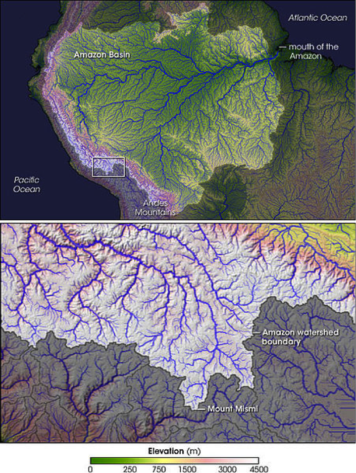
To put this in context, examine the drainage basin of the Amazon River on the maps below. The Amazon basin extends all the way from the western collisional margin of South America where the Andes Mountains are located to the trailing passive margin of the east coast of South America. The Andes Mountains are geologically young and are the result of tectonic uplift associated with subduction. Because of their elevation and size, they provide a large amount of sediment to the Amazon drainage basin that can be carried by the Amazon River to the Atlantic Ocean. Alternatively, the Niger River on the west coast of Africa has its headwaters in low-lying, (compared to the Andes mountains) very old rocks that provide little loose sediment to the river. As a result, the Niger River carries approximately two orders of magnitude less sediment to the ocean than does the Amazon River (Table 2.1).
| Type | River | Sediment Discharge |
|---|---|---|
| Amero-Type | Amazon River | 2000 x 106 tons yr |
| Afro-Type | Niger River | 20 x 106 tons yr |