Tectonics, Sediment Supply, and Morphologies Along Rocky Coasts
Along active collisional margins, tectonic processes have uplifted and deformed rocks to create rugged landscapes with very little sediment input because of immature drainage basins along such geologically youthful landscapes. The presence of recently uplifted mountainous areas can also act as a barrier and prevent river systems from flowing, and thus carrying sediment, to the coast. Moreover, as you learned in Module 2, the relatively narrow and steep continental shelves that are characteristic of active tectonic margins do not help to dampen waves that move onshore from the open oceans. The result is that along active tectonic margins there is little delivery of sediment that could accumulate, and that sediment that does make it to the coast can be easily eroded and transported away by the high wave energy. Globally, there are many different types of morphologies along rocky coasts because of a wide range of rock types, styles of tectonic deformation, hydrographic regime, and styles of weathering.
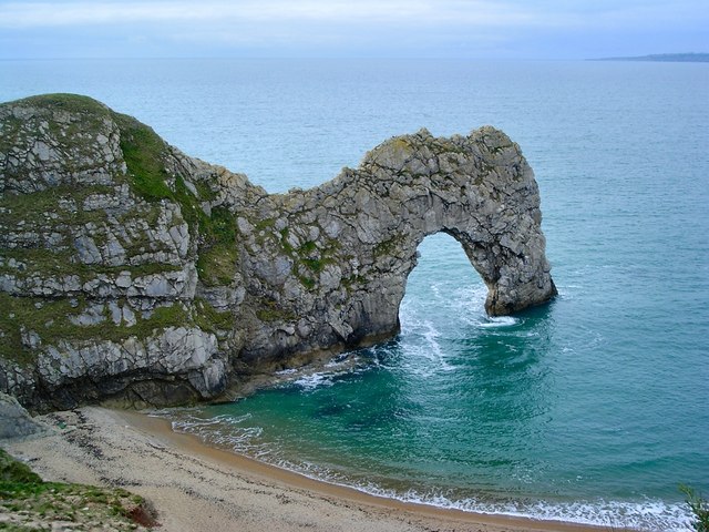
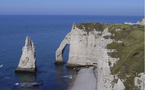
Some of the most spectacular features of rocky coasts include sea arches and sea stacks, which are produced by the constant erosion of waves. A sea arch develops when a headland protruding into the ocean causes waves to refract around it. This refraction of waves concentrates their energy in specific locations along the headland, causing particularly rapid erosion if weakness such as faults and fractures are present in the rocks. In other cases, the waves may simply begin to erode into rock that is less resistant to erosion than the surrounding rock. Either way, the erosion leads to the development of small caves that may eventually meet below a promontory, leaving an arch above. The erosion continues and, for this reason, sea arches are very ephemeral coastal features. When they ultimately collapse, the remnants of the arch are called sea stacks.


For more information on sea arch formation and sea stacks, check out the following videos:
Video: West Wales-Sea Arches & Stacks (3:04)
To understand what's happening, we need to start at the southwestern corner of Wales, in Pembrokeshire. This is one of the most exposed parts of the Welsh coast because the prevailing winds are from the southwest. Waves driven across the Atlantic smash against the cliffs, continually wearing them away.
The harder pieces of coastline, like this headland, only erode quite slowly. But the softer bits, like that bay, get eroded much more quickly. And it's this difference, between hard and soft rocks, that leads to the repeating pattern of bays and headlands.
Although these cliffs are all made of the same material, carboniferous limestone, the rock isn't uniform throughout. It has weak layers, faults, and cracks running through it, all prime sites for erosion.
The erosion is due to several processes. There's hydraulic action, where the crashing waves compress water and air trapped in cracks, weakening and eventually loosening the rock. There's abrasive action, where material suspended in the water get smashed up against the cliff face. And finally, there's chemical action, where the rock is dissolved by sea water and the rain. And just below where I'm standing is an absolutely stunning example of all these processes at work. This is the green bridge of Wales, a fabulous example of a sea arch.
If we go back 5 million years, the coast would have looked like this. First, the sea goes for the weak bands of rock, then it goes for the cracks in the harder rock, forming first arches and then stacks. This leaves the green bridge as we know it today. It's easy to guess what will happen in the future. Not all stacks are formed this way. Sometimes they just get left behind as the coastline around them erodes.
Those stacks will get worn down by the waves and the weather and become stumps like this one.
