Join Dr. Alley and his team as they take you on "virtual tours" of National Parks and other locations that illustrate some of the key ideas and concepts being covered in Unit 8.
TECH NOTE
Click on the first thumbnail below to begin the slideshow. To proceed to the next image, move the mouse over the picture until the "next" and "previous" buttons appear ON the image or simply use the arrow keys.
Virtual Field Trip #1: Cape Cod National Seashore
Source: NASA. All other pictures in this slide show are by R. Alley, C. Alley, J. Alley, or K. Alley.
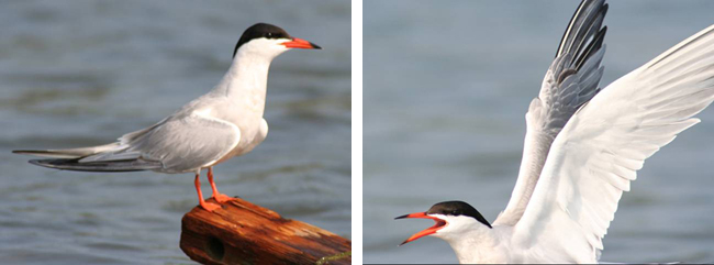
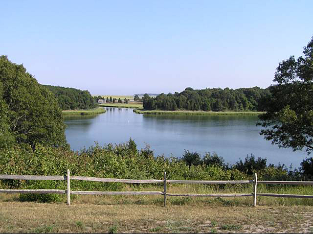
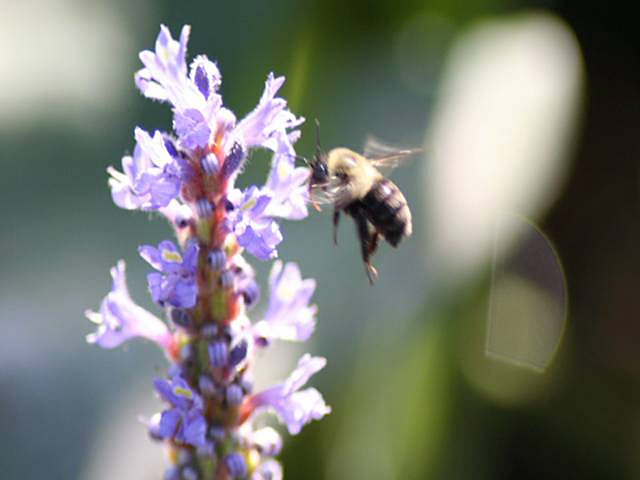
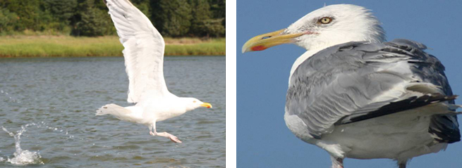
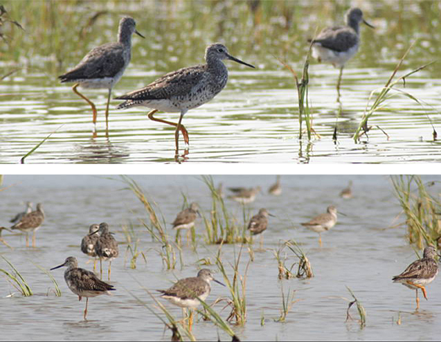
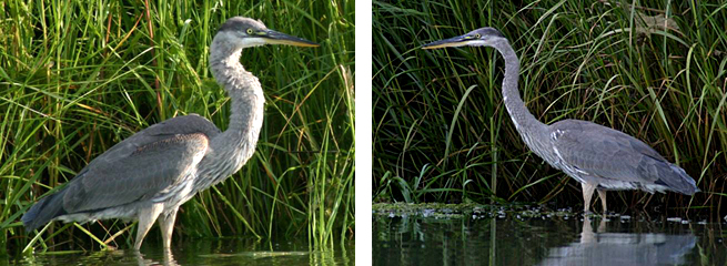
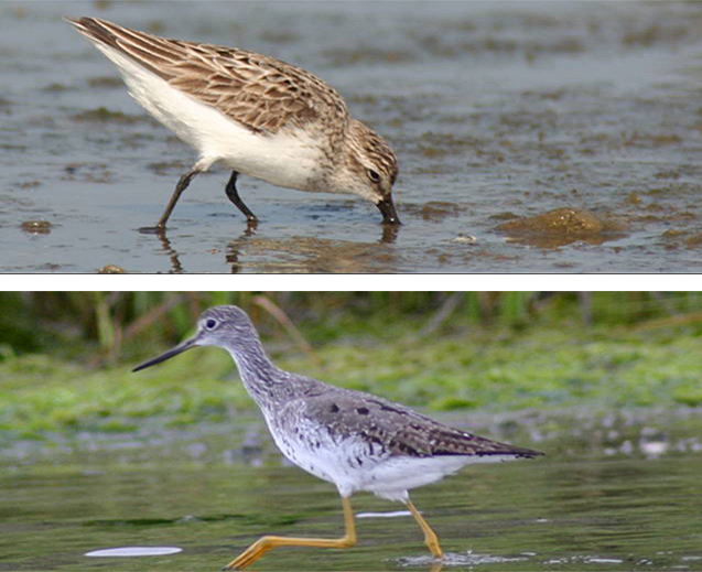
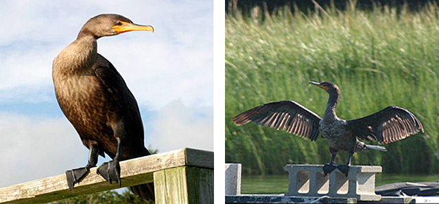
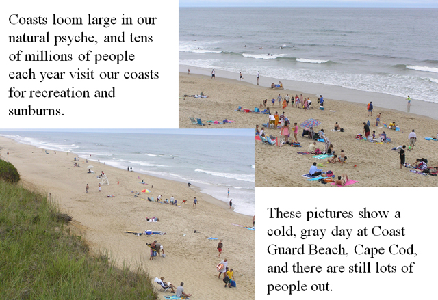
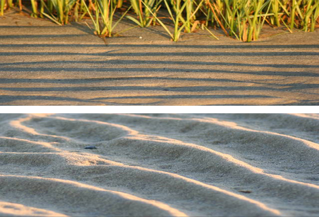
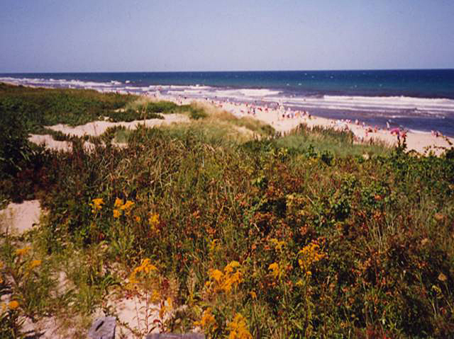
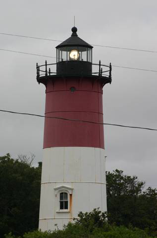
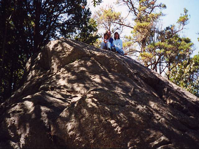
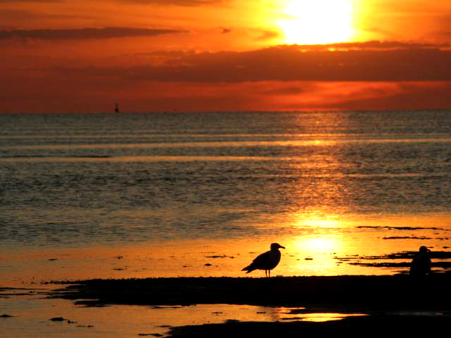
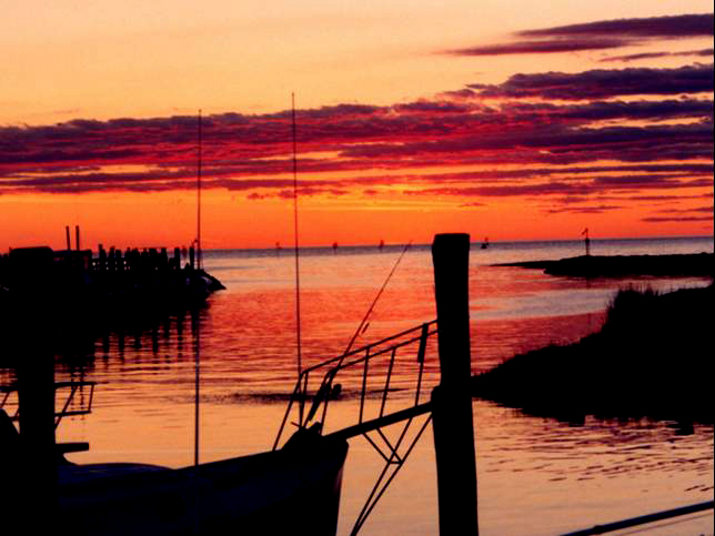
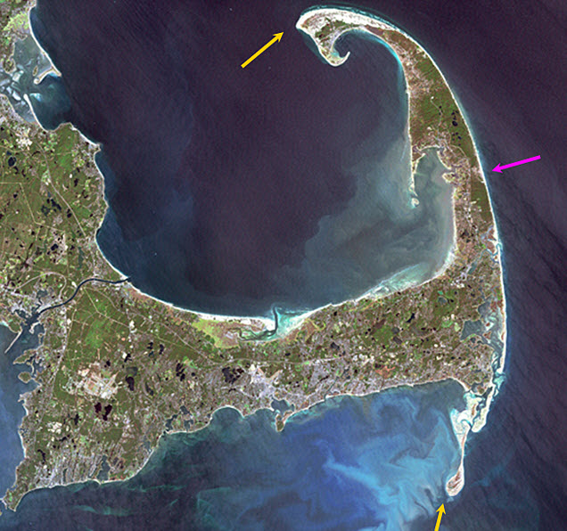
Image 1: Landsat image of Cape Cod. One arrow points to the eroding outer beach on the right. Two more arrows point to areas of sand build out to the south and north. NASA Sept. 18, 1999 Landsat image of Cape Cod. The Outer Beach (magenta arrow) along the right-hand side of the Cape is eroding back at a few feet per year. Some of the sand is building out to the south and north (yellow arrows), but some of the sand is being lost to deeper water, so the Cape is shrinking. All pictures in this slide show, except this one, by R. Alley, C. Alley, J. Alley or K. Alley.
Image 2: On the left, a tern perched on a piece of wood. On the right, a tern in flight. One good tern… deserves another.
Image 3: The Nauset Marsh, Cape Cod National Seashore. Water surrounded by green trees, under pale blue sky. Split rail fence in foreground. The great Nauset Marsh, viewed from the back porch of the Salt Pond Visitor Center, Cape Cod National Seashore.
Image 4: Close-up of a bumblebee on a pickerelweed. Bumblebee visiting pickerelweed, which grows in the shallows at the edge of Great Pond, Eastham, Cape Cod. By building a lake-studded outwash plain into the ocean, the glaciers left a rich mix of aquatic habitats.
Image 5: On the left, a herring gull landing in the water. On the right, close-up of herring gull perched. Gulls, such as these herring gulls, are widespread and successful generalists, equally at home along fresh and salt waters, as well as cleaning up messes left by humans.
Image 6: On top, a close-up of three yellowlegs in Nauset Marsh. Below, twelve or more yellowlegs in the marsh. Yellowlegs are well-named, and common in Nauset Marsh.
Image 7: Side-by-side close-up images of a great blue heron standing in the marsh in front of tall water grass. Great blue herons, Nauset Marsh. A fish that doesn’t watch out may realize too late that he blue it.
Image 8: On top, a close-up of a sandpiper on the beach with his beak in the sand. Below, a close-up of a yellowleg standing in the water. Salt marshes are highly productive, and support a diversity of life… including sandpipers (top) and yellowlegs (bottom). Nauset Marsh, Cape Cod.
Image 9: On the left, a close-up of a cormorant perched. On the right, a close-up of a cormorant on a cinder block with his wings spread. Cormorants were not present on the Cape a few decades ago, but now are commonly seen fishing or drying their wings.
Image 10: Large number of people on the beach at Coast Guard Beach, Cape Cod. slide 10 Coasts loom large in our natural psyche, and tens of millions of people each year visit our coasts for recreation and sunburns. These pictures show a cold, gray day at Coast Guard Beach, Cape Cod, and there are still lots of people out.
Image 11: On top, rippled sand, with beach grass in the background. Below, a close-up of rippled sand. Waves and tidal currents move immense amounts of sand, leaving beautiful ripples, as shown in these closeups from First Encounter Beach.
Image 12: Cape Cod sand dune with a thin layer of hardy vegetation. Ocean in background spotted with beach goers. Cape Cod’s beaches may be backed by rapidly eroding bluffs, by sand dunes covered with a thin layer of hardy vegetation that can be damaged easily by human activities (as shown here), or by salt marshes.
Image 13: Nauset Light, lighthouse on Cape Cod. Nauset Light. The light was moved in 1996, just before the rapid erosion of the bluffs along this part of the coastline dropped this historical building into the waves. Everyone with a long memory of the Cape has stories of things that have been lost to the encroaching sea.
Image 14: Family of three sitting atop Great Rock. Great Rock, the Cape’s largest glacial erratic (big rock carried by the glacier) attests to the ability of ice to move pieces of many different sizes. The rock extends below the picture, and then about as far into the ground as above.
Image 15: Bright orange sunset at First Encounter Beach. Herring gulls in the foreground. Herring gulls at sunset, First Encounter Beach, Cape Cod.
Image 16: Sunset at Rock Harbor, Cape Cod. Boats docked on left. Sunset, Rock Harbor, Cape Cod. It isn’t very geological, but it’s pretty.
Virtual Field Trip #2: Acadia National Park
.jpg)
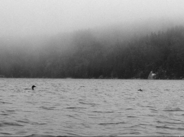
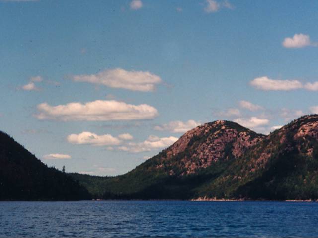
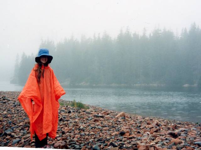
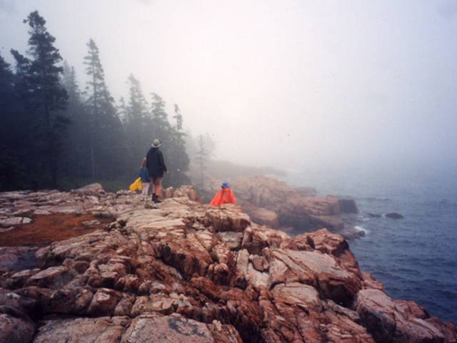
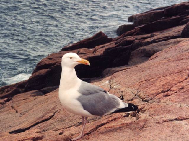
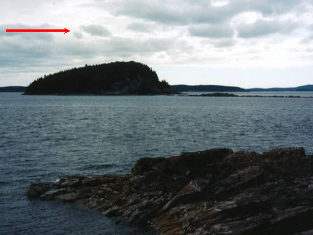
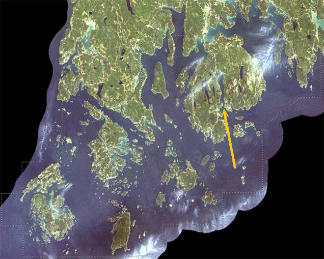
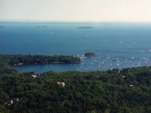
Image 1: Satellite Image of Rhode Island Acadia and surroundings. Arrow points to the fjord of Somes Sound in Mount Desert Island. Credit: NASA GSFC & Y.Q. Wang at the Laboratory for Terrestrial Remote Sensing, Univ. Rhode Island Acadia and surroundings. The yellow arrow points toward the fjord of Somes Sound in Mount Desert Island. The dotted line marks an area of interest for NASA and the National Park Service, and regions beyond have been blacked out. All pictures except this by C. or R. Alley
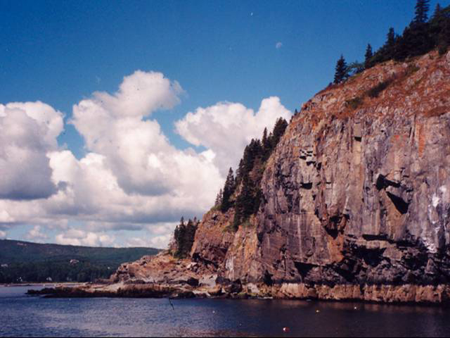
Image 2: Lobster pots floating in water in front of large cliffs. Blue skies with puffy white clouds. The old metamorphic rocks (shown here) and granites of Acadia make dramatic cliffs. Floats for a few lobster pots are visible in the water.
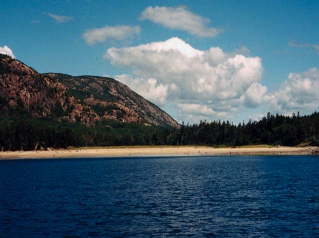
Image 3: Beach at Acadia with water in foreground, mountains and cloudy skies in background. This beach at Acadia is one of the few in the area. Most of the sand is calcium carbonate--ground-up shell--because the Gulf of Maine is so amazingly productive of shells to be ground up by waves. The beach is far at the end of an inlet; the rest of the coast is dominated by bare rock.
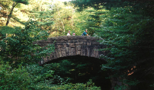
Image 4: Family on bicycles crossing an arched stone bridge, surrounded by forest. The Rockefeller-constructed carriage roads and their graceful bridges are well-loved at Acadia, which offers wonderful opportunities for bicycling. Dr. Alley and daughters Janet (left) and Karen for scale.
Image 5: Ocean with inlet and forested land in foreground, small islands in the distance. Sailboats anchored in the inlet and sailing in the distance. View of the Maine coast from Cadillac Mountain, Acadia.
Image 6: On left, path leading to Bass Harbor Head Lighthouse. On right, Portland Head Lighthouse, two red roofed buildings, ocean in background. Bass Harbor Head Lighthouse (left) and Portland Head Lighthouse (right), Acadia National Park and vicinity.
Image 7: Two loons in the rain on Seal Cove Pond. Black and white image. Loons in rain, Seal Cove Pond, Acadia. The deep, glacially carved lakes of the island are outstanding for kayaking and canoeing.
Image 8: Blue waters of Jordon Pond with Bubble Mountains in background, under pale blue cloudy sky. Jordan Pond and the Bubble Mountains. The rounded granite summits and U-shaped valleys are clear evidence of past ice.
Image 9: Person standing in the rain on rocky beach, wearing orange rain poncho and blue rain. Water and Evergreens in the background. Even a rainy day can be enjoyable on the shore, as here at Ship Harbor. Notice the “beach” is composed of cobble-sized rocks.
Image 10: People standing on rocks at the coast. Raining and foggy. Acadia National Park. The no-beach granite coast of Acadia National Park in the fog.
Image 11: Close-up of Herring gull standing on granite coast of Acadia. This herring gull is perched on the granite coast of Acadia.
Image 12: Body of water with island in center. Cloudy skies. Arrow at top left points to the right, indicating direction of ice flow. Ice flow as indicated by the red arrow smoothed this island, and plucked rocks off the lee or down glacier side to the right.
Virtual Field Trip #3: Coasting Down the Coast.
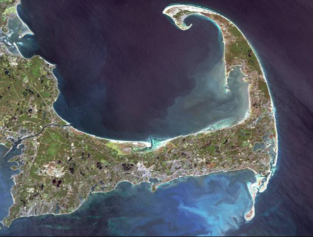
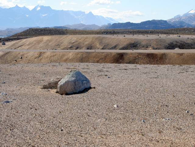
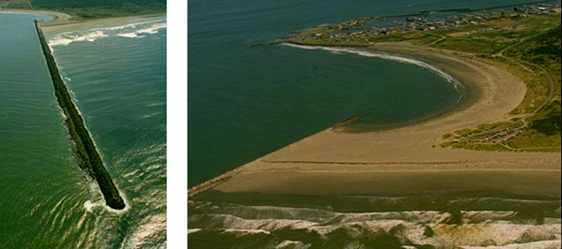
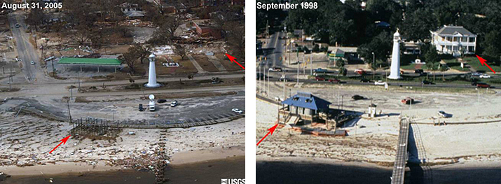
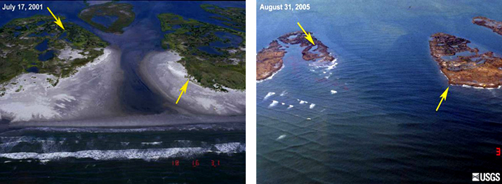
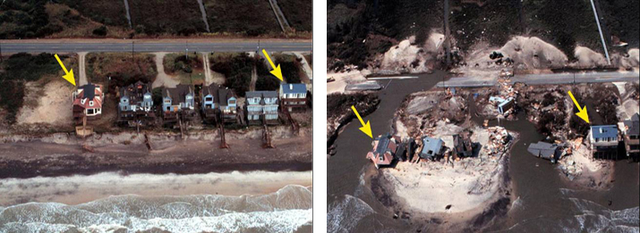
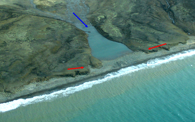
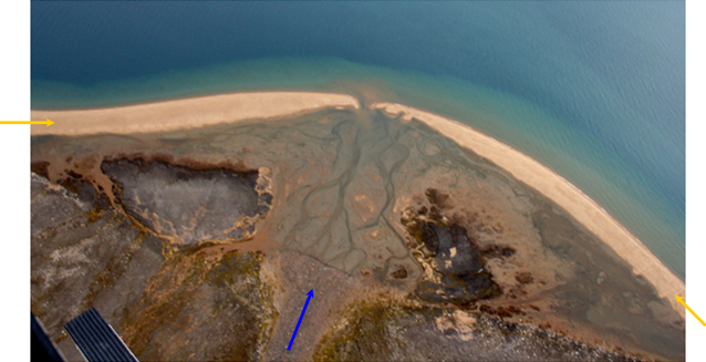
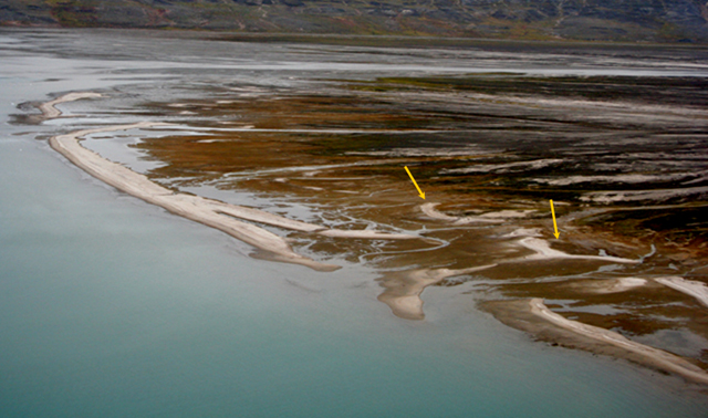
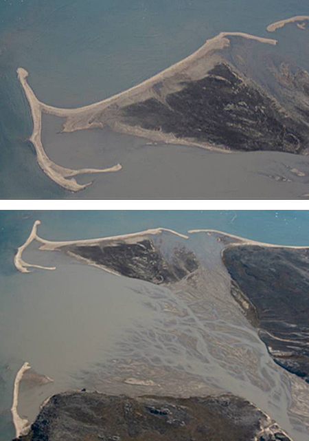
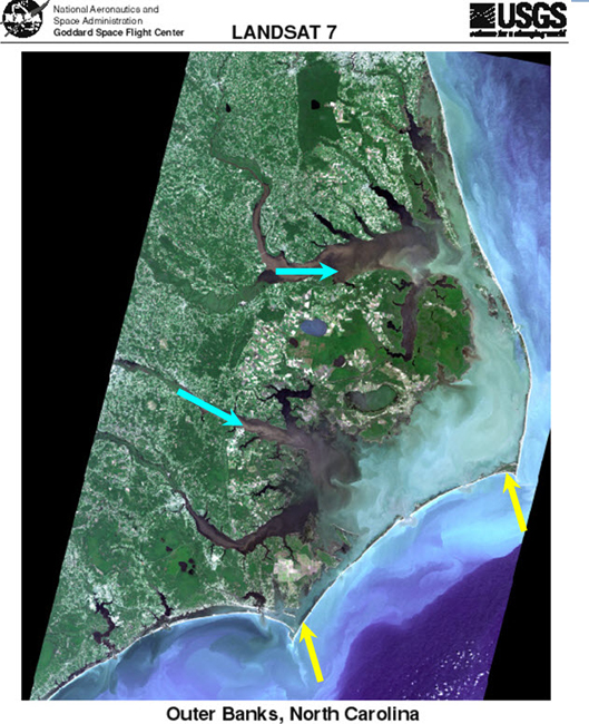
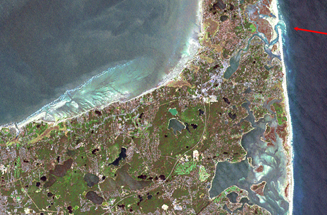
Image 1: Satellite image of Cape Cod National Seashore and surroundings. Coasting Down the Coast. Including a bit on sea-level change, some disasters, and some coastal processes, in some beautiful places. All pictures by R. Alley or taken from government Web sites as indicated. The image of Cape Cod National Seashore and surroundings is from Landsat 7.
Image 2: Raised delta, Milne Land, east Greenland. Rock in center foreground. Mountain peaks in background. Raised delta, Milne Land, east Greenland. About 12,000 years ago, a stream flowing to the left from beneath a glacier built the sandy fingers of this delta out into the sea. Then, the ice melted, allowing the land to rise, so the delta is now about 300 feet above sea level (sea is barely visible to the far left).
Image 3: A wall called a jetty built out from the coast in Washington, which has trapped sand on one side but caused erosion on the other side. Washington State Department of Ecology Shore photos--the state photographed their coasts, and makes these pictures available to the public--what a great idea! Two views of the Westport Jetty, Washington. Longshore drift from the right has built up sand to the right but caused erosion to the left of the barrier. Also notice in the left picture that waves are slowed by the shallower waters near the jetty.
Image 4: Hurricane Katrina aftermath. On right arrows point to antebellum and pier house. On left arrows point to where buildings used to be. http://coastal.er.usgs.gov/hurricanes/katrina/photo-comparisons/mainmiss... Before-and-after photos of the aftermath of Hurricane Katrina, near Biloxi, Mississippi. The antebellum house (upper right) and pier house indicated by the red arrows were destroyed.
Image 5: A picture showing tree-covered islands before Hurricane Katrina, and the smaller, treeless islands left after the storm. http://coastal.er.usgs.gov/hurricanes/katrina/photo-comparisons/chandele... Before-and-after photos of the impacts of Hurricane Katrina on the Chandeleur Islands, about 100 miles east of New Orleans. The sites marked by the yellow arrows can be identified in both photos.
Image 6: Hurricane Katrina aftermath. On left houses on Topsail Island, N. Carolina. On right, the same houses are destroyed. Before-and-after photos of the impacts of Hurricane Fran (1996) on Topsail Island, North Carolina. The house indicated by the left yellow arrow largely collapsed, that shown by the right yellow arrow lost its deck, and most of the other houses and much of the road were destroyed.
Image 7: A small stream draining into a Greenland fjord is dammed by sediment transported along the fjord shore. Evidence of longshore drift of sediment, Scoresby Sund, Greenland. The small stream valley flowing from the top (blue arrow) has been dammed by sediment transported along the coast (between the red arrows).
Image 8: Aerial view of delta, arrow points to sediment from stream that formed delta, two arrows point the beaches on each side. Sediment supplied from the stream (blue arrow) formed the delta. Waves have reworked the edge of the delta into the sandy beach (yellow arrows). Much of the area on the delta side of the beach is underwater at high tide, so this is a barrier beach. A helicopter skid is visible in the lowermost left corner.
Image 9: A braided river has wave-formed beaches near the sea; a recent storm moved some beaches well inland. Barrier beach, Mudder Bugt, Milne Land, east Greenland. Sand supplied from the right by the braided river has been reworked into the beaches shown. Storms have breached the beach on the right, washing sand into the lagoon behind and forming secondary beaches (yellow arrows).
Image 10: A delta formed by a braided river is surrounded by beaches and spits formed from the sand carried by the river. Mudder Bugt, Milne Land, east Greenland. The upper picture is a slightly turned close-up of the top part of the lower picture. Sand from the braided stream (lower right) is reworked by waves into the barrier beaches and spits seen, but the beaches are pierced by inlets.
Image 11: Satellite image of North Carolina, showing streams that deliver sand and barrier islands made from that sand. Satellite image of the Outer Banks of North Carolina, from USGS and NASA. Streams flowing from the left (two are indicated by blue arrows) have been flooded by sea-level rise in their lower reaches. Sand from the streams has been built into barrier islands (two shown by yellow arrows). Although the area covered by this picture is much bigger, the features are clearly almost identical to those shown in the previous pictures.
Image 12: Satellite image of Cape Cod. Arrow in upper right points to inlet to Nauset marsh piercing the great barrier beach. NASA Closeup of part of Cape Cod. The great barrier beach on the right is pierced by the inlet to the Nauset marsh (red arrow).