
Wave, Mixed Energy, and Tide Dominated Hydrographic Regimes
Our understanding of waves and tides now sets the stage for a more thorough understanding of how they interact to shape a coastal zone. In the context of the hydrographic regime, there are two fundamental things that must be considered: the wave and tidal energy of a coast.
- Wave energy (E) is a function of wave height (H) with the energy (E) of a wave approximately equal to the square of the wave height (H2).
- Tidal energy can be equated with tidal range because it is the rise and fall of the tides that produce tidal currents. Tidal range (TR) is the vertical difference between high and low tides, which are commonly categorized into three ranges:
Microtidal: TR < 2.0 m
Mesotidal: 2.0 m < TR < 4.0 m
Macrotidal: TR > 4.0 m
The relative dominance of wave versus tidal energy dictates coastal morphology, and three general regimes exist along depositional coasts:
- Wave Dominated Coasts
- Mixed Energy Coasts
- Tide-dominated Coasts
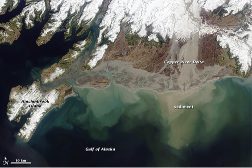
Wave Dominated Coasts
Along wave-dominated coasts, the role of the waves and, thus, longshore transport processes is the dominant factor controlling the coastal morphology. Because longshore transport carries sediment along the shore, these types of coasts tend to have long linear barrier islands and beaches with relatively few inlets or passes between the open ocean and the more interior bays and waterways. The reason for this is that the longshore transported sediment tends to fill in these inlets and passes. Since the tidal currents are relatively weak, there is no energy available to keep the inlets open as a connection between the open ocean and interior waterways.
Mixed Energy Coasts
Mixed energy coasts are a product of both wave and tidal processes and neither process exerts an excessive influence on the coastal morphology, although some mixed energy coasts show tidal or wave dominance. Rarely in nature are processes in equilibrium. These types of coasts typically contain short stubby barrier islands, have numerous tidal inlets and passes, and are separated from a mainland by extensive marshes and an array of tidal creeks.
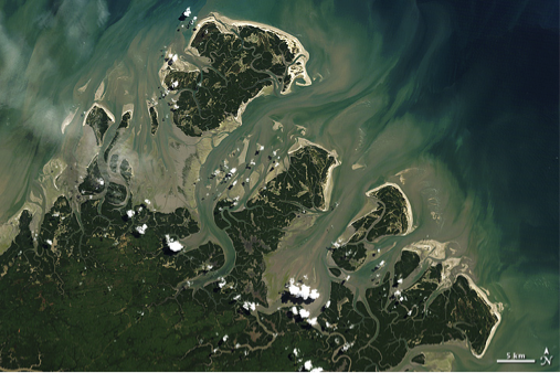
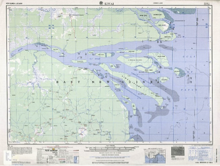
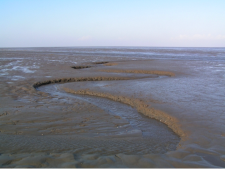
Tide Dominated Coasts
Tide dominated coasts are those where strong tidal currents act to redistribute sediment along the vector of falling and rising tidal currents, which are orientated perpendicular to the trend of the coastline. Quite often, the highest energy tidal currents develop in locations where large tidal ranges are present in conjunction with a shoreline morphology that accentuates tidal flow by constricting tidal currents into funnel-shaped embayments. Sediment is reworked by the resulting tidal currents to create subaerial and subaqueous tidal shoals and islands that are aligned parallel to the tidal flow direction, perpendicular to the coastline. Moreover, in areas with very large tidal ranges, extensive tidal flats, and marsh or mangrove systems form along the borders of the embayment and can cover large areas.