Join Dr. Alley and his team as they take you on "virtual tours" of National Parks and other locations that illustrate some of the key ideas and concepts being covered in Unit 7.
TECH NOTE
Click on the first thumbnail below to begin the slideshow. To proceed to the next image, move the mouse over the picture until the "next" and "previous" buttons appear ON the image or simply use the arrow keys.
Virtual Field Trip #1: Yosemite National Park
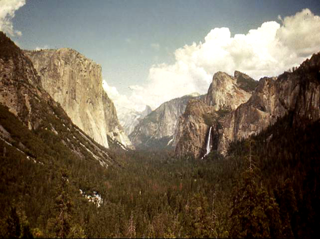
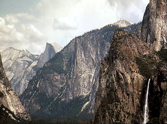
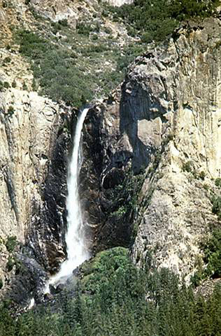
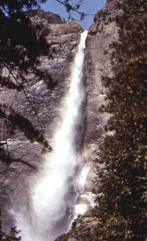
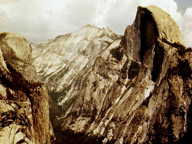
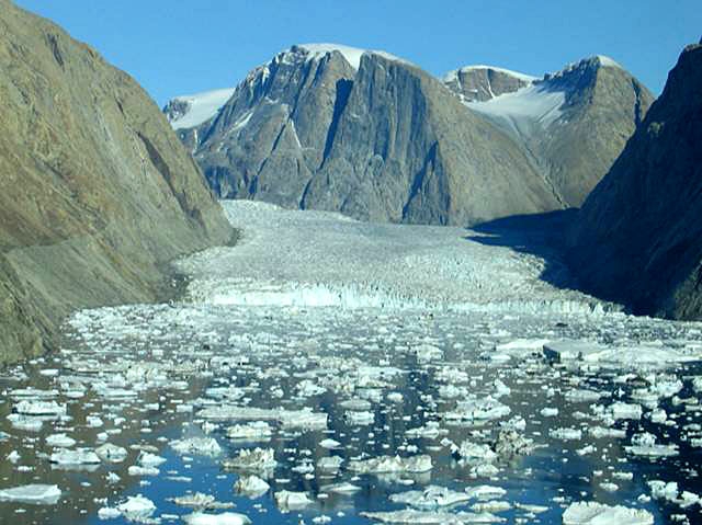
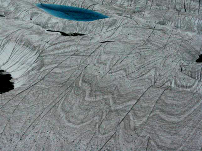
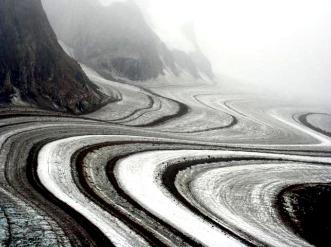
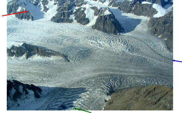
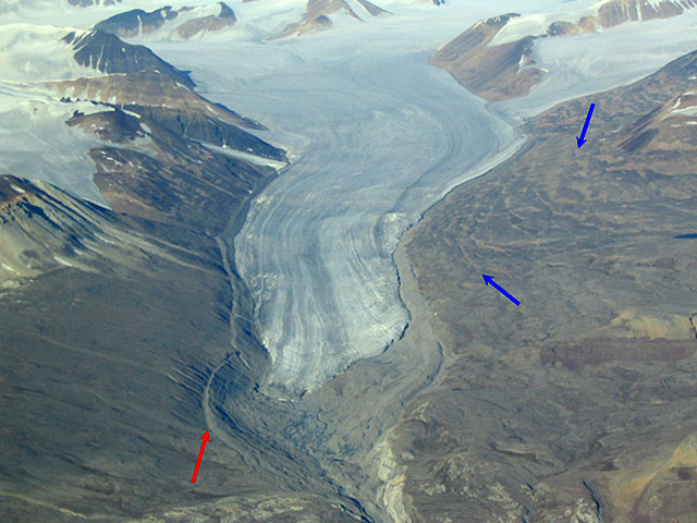
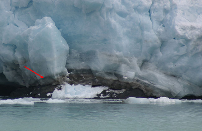
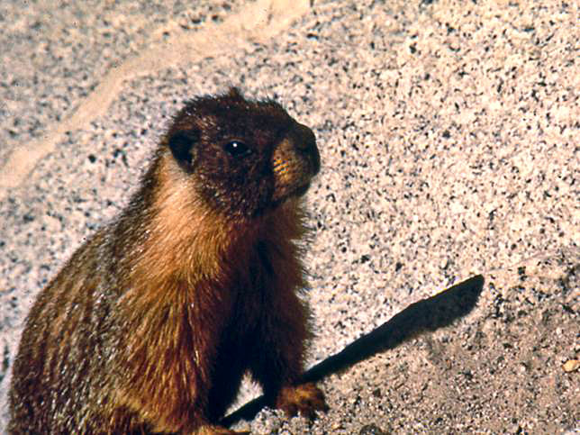
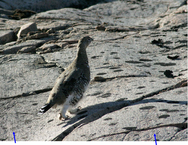
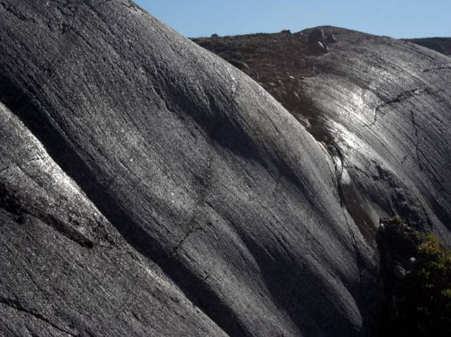
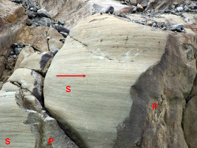
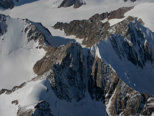
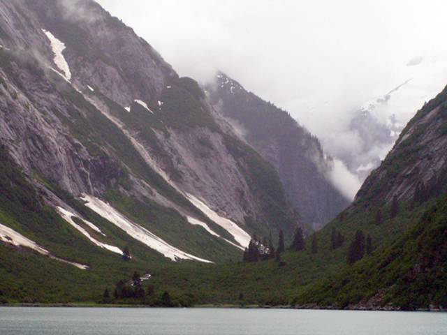
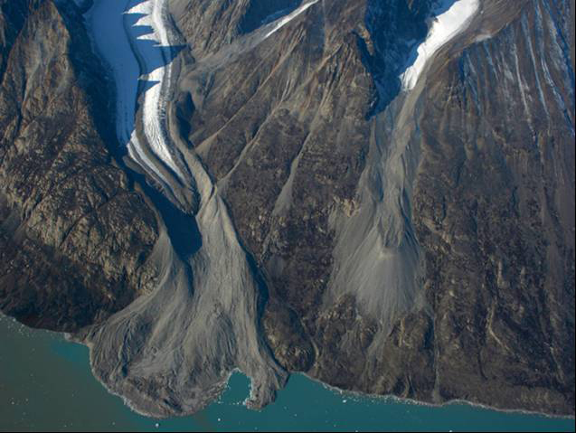
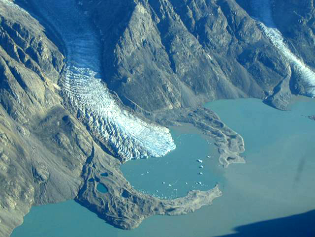
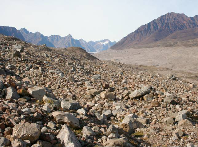
Image 1: Yosemite valley under cloudy skies. Forest in the foreground and mountains in the background. Bridalveil Falls on right in distance. Tracking the Great Glaciers from Yosemite to Greenland and Alaska. Yosemite truly is an incomparable valley. Bridalveil Falls, on the right, is a hanging valley; its small glacier did not cut downward as rapidly as the main glacier. All photos by R. Alley.
Image 2: Yosemite valley under cloudy skies. Bridalveil Falls in the foreground to the right. Closer view of Bridalveil Falls, right. The U-shape of the valley of Bridalveil Creek shows that it was glaciated.
Image 3: Close-up of Bridalveil Falls, Yosemite. Rock cliffs to each side of falls. Green shrubs just above the falls and forest below. Bridalveil Falls, Yosemite National Park. Bridalveil Creek has just started to cut a notch into the U-shaped cross section of the former glacial valley. The rapids at the bottom of the waterfall is running on rocks dumped there by the creek; eventually, the waterfall will be completely transformed into a rapids unless another ice age brings glaciers to re-form the waterfall.
Image 4: Close-up of Lower Yosemite Falls under blue sky, Yosemite National Park. Rock cliffs to each side and large evergreen in right foreground. Lower Yosemite Falls, Yosemite National Park. The numerous waterfalls of the park exist because the ice-age glaciers eroded the tremendous cliffs of the valley.
Image 5: Yosemite Valley, California. The deep, U-shaped valley was carved by glaciers. Half Dome above Yosemite Valley. A glacier flowing to the lower right deepened and widened the valley; see the next slide for a modern example.
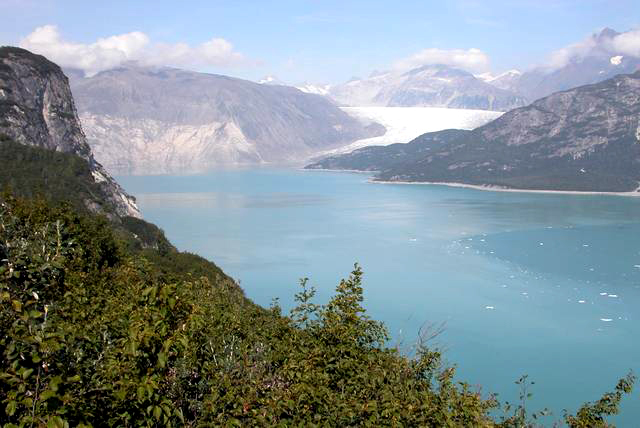
Image 6: A valley in east Greenland that is about the same size and shape as Yosemite, but still contains the glacier that is carving it. Glacier draining Greenland Ice Sheet into head of Scoresby Sund, NE Greenland National Park. The scale is similar to that in the previous picture. Yosemite’s glaciers ended on land; this one calves icebergs into the fjord.
Image 7: Ice sheet, NE Greenland National Park. Wave-shaped folds are visible, showing flow of ice. Bright blue meltwater lake visible, top left. Near ice-sheet edge, NE Greenland National Park. The folds show that ice flows. Blue at top is a meltwater lake; such lakes may drain to the bed.
Image 8: Corridoren Glacier, Greenland. Very visible medial moraines, dark and light wavy stripes. Corridoren Glacier, Greenland. The stripes are medial moraines, rock debris picked up from ridges where two tributary glaciers join.
Image 9: Tributary glaciers joining in NE Greenland National Park. Arrows point to accumulation area, lakes in ablation zone, and medial moraine. Several tributary glaciers joining; flow is to right. NE Greenland National Park. Accumulation area in cirque (red arrow), lakes in ablation zone (green arrow) and medial moraine (blue arrow) are visible.
Image 10: Glacier in east Greenland, with high-elevation accumulation zone, low-elevation ablation zone, and older, lower elevation moraines. Accumulation zone in cirques (top), ablation zone (bottom), 150-year-old moraine (red), subtle, 11,500-year-old moraines (blue), NE Greenland Natl. Park.
Image 11: Close-up of glacier in south Greenland. Arrow points to debris-bearing basal ice. Water in foreground. Debris-bearing basal ice (red arrow) of a glacier in south Greenland. Rocks in such ice sandpaper, or abrade, the bedrock beneath as the ice moves.
Image 12: Close-up of a marmot on granite that has been abraded by debris-bearing glaciers, highlands of Yosemite National Park. The granite behind George the marmot has been abraded by debris-bearing glaciers, in the highlands of Yosemite National Park.
Image 13: Close-up of a Rock Ptarmigan on glacially striated granite, east Greenland. Arrows point to striae which are faint lines on rock. Rock ptarmigan on glacially striated granite (striae are faint lines on rock; a few of many are shown by blue arrows), east Greenland.
Image 14: Glacially striated and polished bedrock under blue sky. East Greenland. Glacially striated and polished bedrock, east Greenland. Ice flowed up the cliff from the lower right.
Image 15: Glacially abraded and plucked rock in fjord wall S. Greenland. Arrow shows ice came from left. “S” marks scratched area, “P” plucked area. Glacially abraded and plucked rock in fjord wall, S. Greenland. The ice came from the left, as indicated by the arrow, scratching/abrading (S) some places and plucking (P) others. Picture is about 10 feet across.
Image 16: Several small snow avalanches into a cirque surrounded by layered rock peaks, east Greenland. Small snow avalanches into a cirque, east Greenland. The layered rocks are flood basalts from opening of the Atlantic Ocean.
Image 17: Horn, Stauning Alps, NE Greenland National Park. Several cirques intersect and leave a towering peak. Horn, Stauning Alps, NE Greenland National Park. Several cirques have intersected to leave this towering peak.
Image 18: U-shaped valley in Tracy Arm Wilderness Area, Alaska. Thick cloud cover, highway in foreground. U-shaped valley from glacial erosion, Tracy Arm Wilderness Area, Alaska.
Image 19: Aerial view of moraines around retreating glaciers, Aple Fjord, NE Greenland National Park. Moraines around retreating glaciers, Alpe Fjord, NE Greenland Natl. Park.
Image 20: Aerial view of moraines around retreating glaciers, NE Greenland National Park. Moraines around retreating glaciers, NE Greenland Natl. Park.
Image 21: Deposits of Bjornbo Glacier, NE Greenland National Park. Rock pieces in foreground and mountains in background. Deposits of Bjornbo Glacier, NE Greenland Natl. Park. Ice was here about 1850. Glaciers carry pieces of different sizes, which make till when deposited.
Virtual Field Trip #2: Glacier, Glaciers and Glaciation: The Ice Really Was Bigger, Glacier National Park
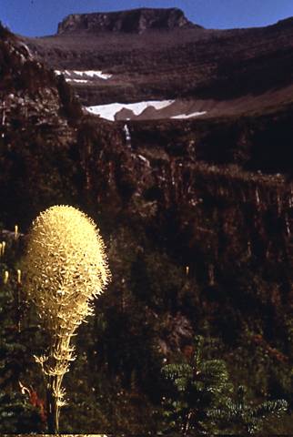
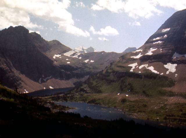
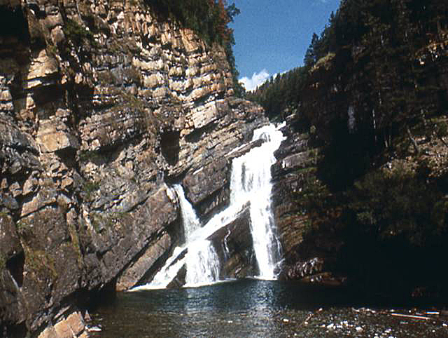
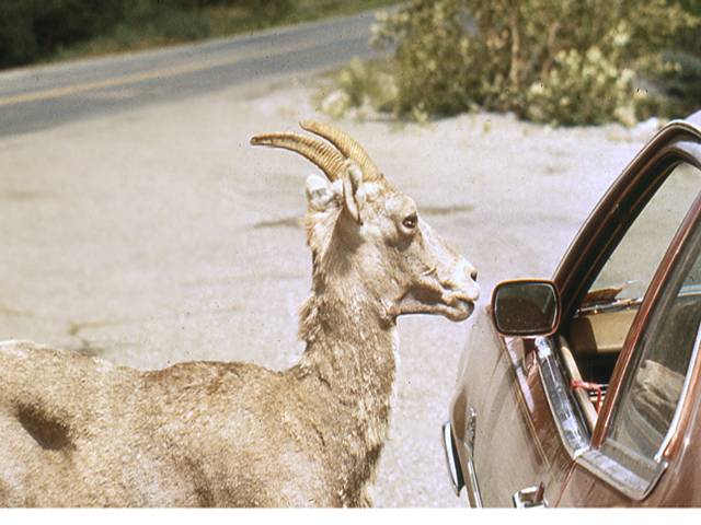
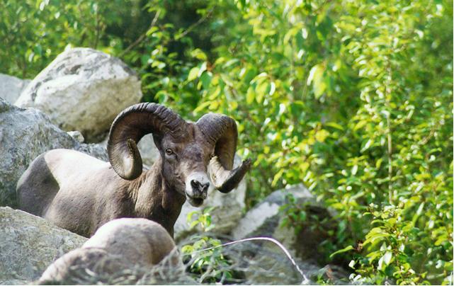
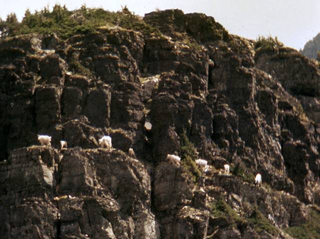
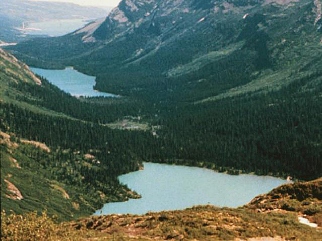
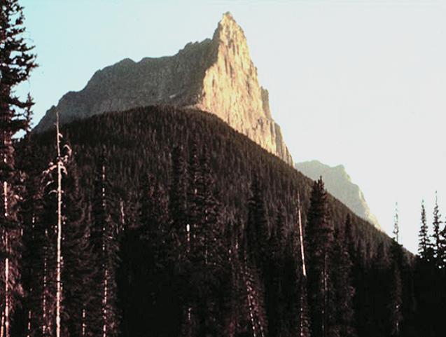
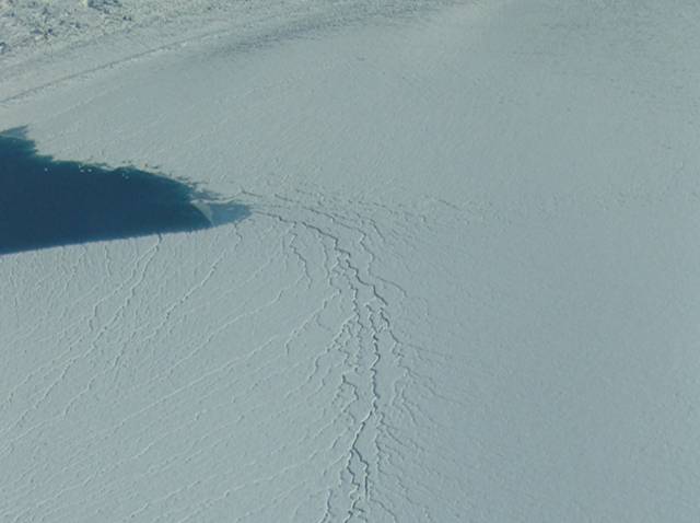
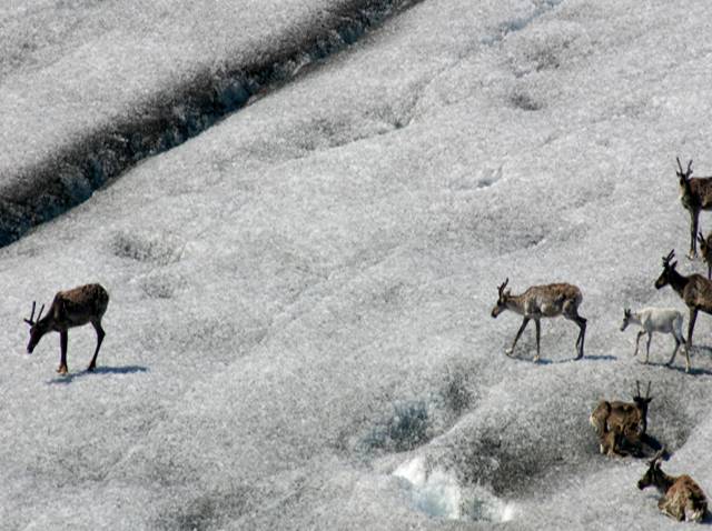
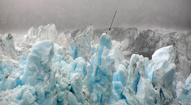
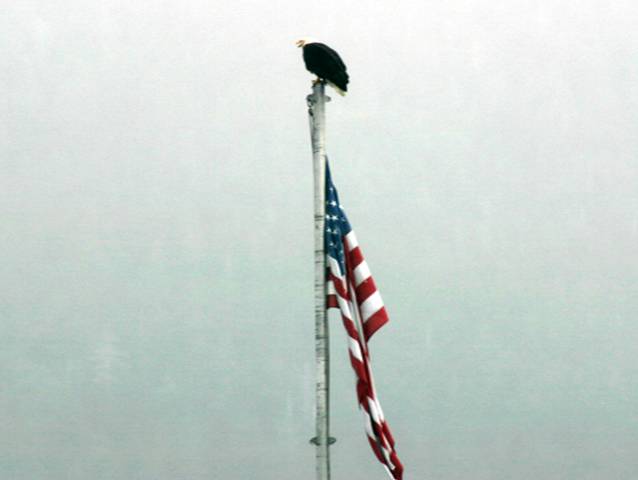
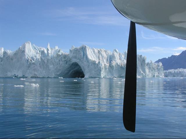
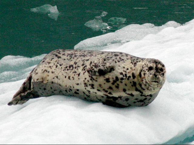
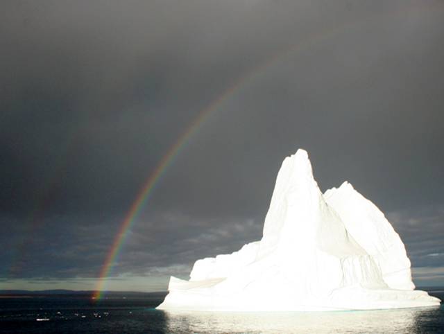
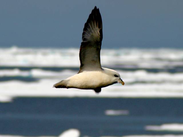
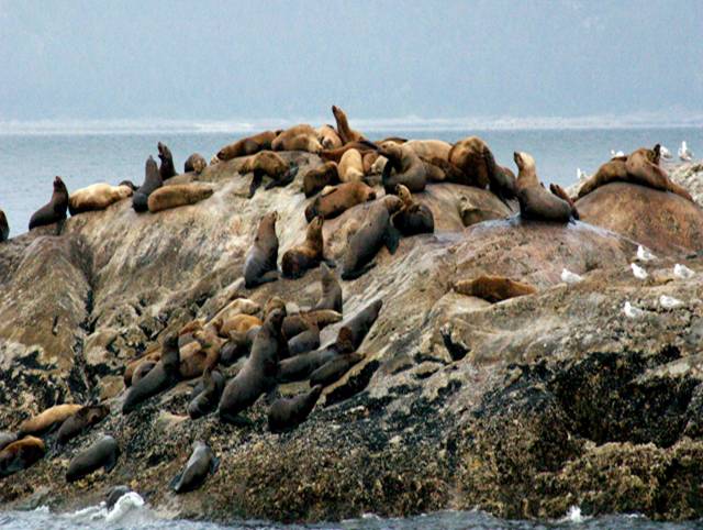
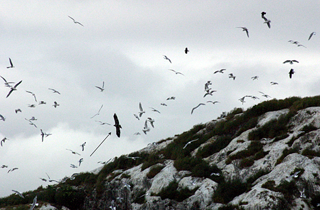
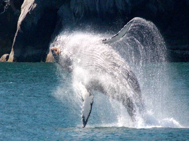
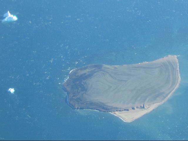
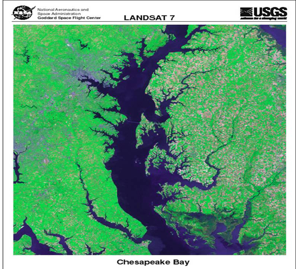
Image 1: Glacier-free cirque under blue sky in Glacier National Park, Montana. Bear Grass blooming in left foreground. Bear Grass (really a lily, not a grass) blooming in a glacier-carved but now glacier-free cirque along Going-to-the-Sun Road, Glacier National Park, Montana. All photos by R. Alley, except for some of the Alaska pictures, which are by either R. Alley, C. Alley, J. Alley or K. Alley, and we’re not sure on some of them because we kept trading cameras.
Image 2: Glacier-carved scenery, Logan Pass, Glacier National Park. Snow-spotted mountains under cloudy skies, water in foreground. Glacier-carved scenery, Logan Pass, Glacier National Park.
Image 3: Comeron Falls, Waterton Lakes, Alberta, Canada. Water falls from different heights and at different angles. Cameron Falls, Waterton Lakes, Alberta, Canada (Glacier-Waterton Lakes International Peace Park). The rocks were folded by mountain-building, and the waterfall follows the bent layers.
Image 4: Female bighorn sheep at driver’s side window of car. Glacier National Park. Female bighorn sheep, Glacier National Park. In search of salt, she was going from car to car, licking steering wheels where perspiring hands had left deposits.
Image 5: Male bighorn sheep among boulders, greenery in background. Canada, near Glacier National Park. Bighorn sheep. This ram was over the border in Canada, but surely has relations in Glacier.
Image 6: Eight mountain goats on mountain side in Glacier National Park. Mountain goats are aptly named. Glacier National Park.
Image 7: Glacier National Park. Valley with green mountainsides and two “paternoster” lakes in view. Glacially carved “paternoster” lakes, Glacier National Park.
Image 8: Cliff in Glacier National Park, that was eroded when it was the side of a glacier that since melted away. Glacially truncated cliff. The ridge on the left was cut off by a glacier that reached at least as high as the sunlit peak, and that flowed over the point where the photographer stands. Glacier National Park.
Image 9: Surface of Greenland Ice sheet with view of melterwater stream entering blue lake at left center. Meltwater stream entering lake, surface of the Greenland Ice Sheet. At higher elevation, the ice-sheet surface is just snow. Such ice sheets now cover 1/10 of the Earth’s land, but during the last ice age covered almost 3 times more.
Image 10: Eight caribou on the dulled white surface of the Greenland ice sheet. Caribou on the surface of the Greenland ice sheet, here about 1 mile from the edge, avoiding mosquitoes. Healed crevasses are evident. This is in the ablation zone, and meltwater plus wind-blown dust have dulled the white snow.
Image 11: Margerie Glacier, Glacier Bay National Park. Blue ice visible in foreground, background glaciers grey. Bald Eagle sits on peak in center. Bald eagle (arrow) on top of Margerie Glacier, Glacier Bay National Park, Alaska. Glaciers can be large. Glacier ice is blue, as seen here, for the same reasons that water is blue (preferential absorption of red by water molecules).
Image 12: Bald Eagle sitting atop a flag pole in Sitka, Alaska, near Glacier Bay National park. Bald eagle, Sitka, Alaska, near Glacier Bay National Park, in case you wanted to know what the bald eagle in the previous picture looks like. Mostly, this is an excuse to stick in a cool picture.
Image 13: Northwest Fjord, east Greenland. Iceberg under blue sky and surrounded by blue water. Float-plane propeller right foreground. Iceberg behind float-plane propeller, Northwest Fjord, east Greenland. The berg reaches about 400 feet above the water, and is close to one-half-mile long.
Image 14: Harbor seal on small iceberg, Glacier Bay national Park, Alaska. Harbor seal on very small iceberg, Glacier Bay National Park, Alaska. Glaciers lose mass either by melting, or by calving icebergs.
Image 15: Cloudy skies and double rainbows over a bright white iceberg in Scoresby Sound, NE Greenland National Park. Rainbow above iceberg, Scoresby Sound, NE Greenland National Park. Icebergs are highly relevant to the study of glaciers and ice ages, but we’re not above sticking in pictures primarily because they’re pretty.
Image 16: A Fulmar in flight over a sea of ice, NE Greenland National Park. Fulmar in front of sea ice, NE Greenland National Park. Sea ice is frozen ocean water, usually less than 10-20 feet thick. Icebergs calve from glaciers formed from snowfall, and can be more than 1000 feet thick and the size of small states.
Image 17: Marble Island, Glacier Bay National Park, Alaska, covered with sea lions. Marble Island, in Glacier Bay National Park, Alaska, was scoured smooth by glaciers, and is now home to numerous sea lions.
Image 18: A bald eagle soars among a large number of sea gulls and ravens at South Marble Island, Glacier Bay National Park, Alaska. An immature bald eagle (arrowed) concerns the gulls and ravens of South Marble Island, a glacially scoured rock in Glacier Bay National Park, Alaska.
Image 19: A humpback whale breaching in the fjords of Glacier Bay National Park, Alaska. The deep, glacially carved fjords of Glacier Bay National Park and surrounding Alaska are home to humpback whales and other charismatic macrofauna (big, cute critters).
Image 20: Small island in Kong Oskar Fjord,Greenland, with raised beaches that formed as the island rose from the ocean. Raised beaches form a bulls-eye on this small island in east Greenland. Melting of ice sheets raised global sea level at the end of the ice age, but some regions that had been depressed under the former ice sheets rebounded faster than the sea rose, raising beaches out of the water.
Image 21: Satellite image of Chesapeake Bay, an old river valley that was flooded by the rising sea as the ice-age sheets melted. Satellite image of Chesapeake Bay. Geological study of the Bay and its surroundings confirms what you can see by inspection: the bay is a drowned river valley, indicating either that sea-level rose or the land fell fairly recently (mud is filling the bay; if the change happened a long time ago, the bay would be filled). Similar features along many coasts, including those being raised tectonically, show that sea level rose rather than the land falling.
Virtual Field Trip #3: Bear Meadows
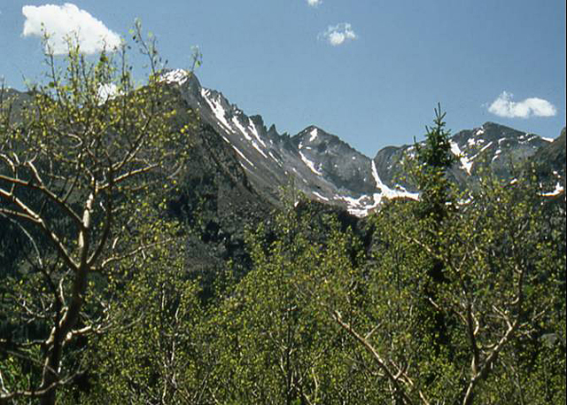
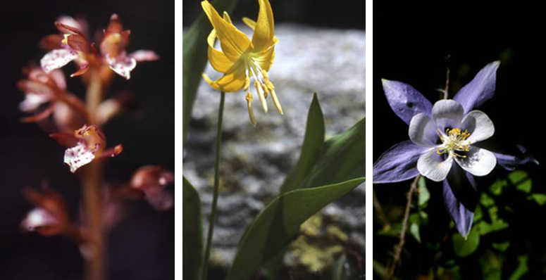
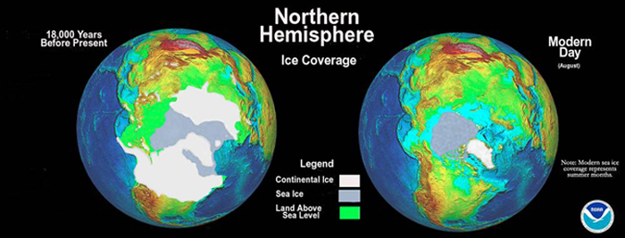
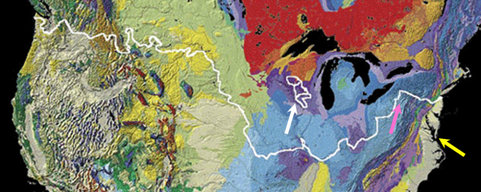
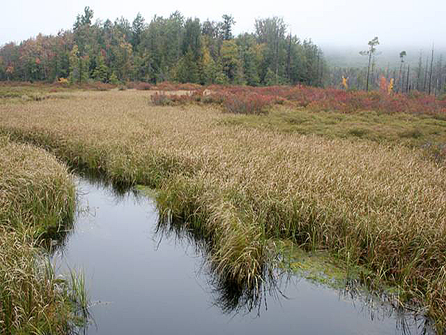
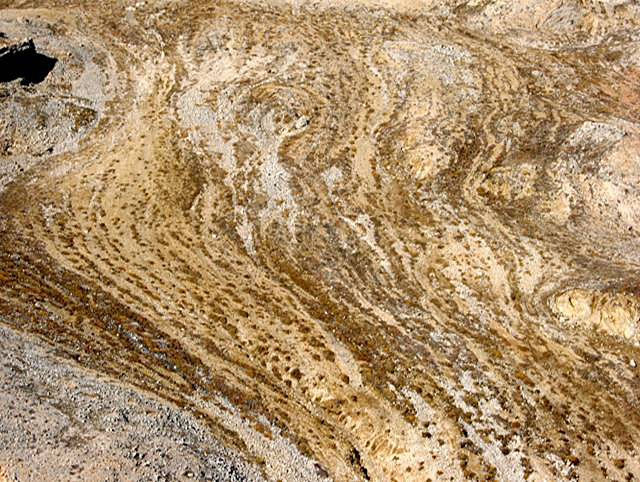
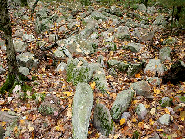
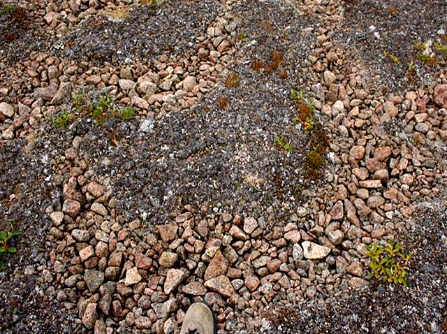
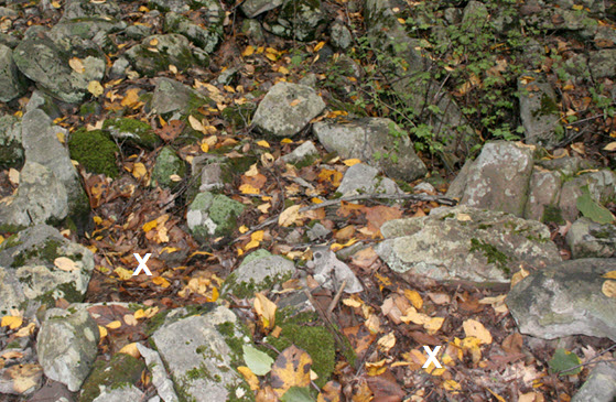
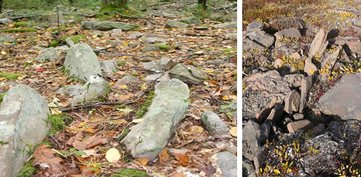
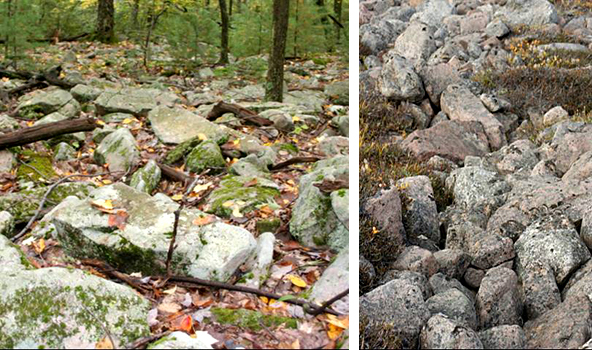
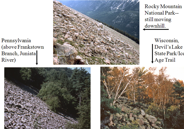
Image 1: Snow spotted Rocky Mountains, greens trees in foreground. What do Rocky Mountain, Bear Meadows, and Greenland have in common? Hint: It’s cold up there on top of Rocky Mountain… All photos by R. Alley, maps from USGS and NOAA
Image 2: Three side-by-side close-ups of flowers. On the left, spotted coral-root orchid. Center, Glacier lily. Right , blue columbine. First, some Rocky Mountain wildflowers. left: Spotted coral-root orchid, middle: Glacier lily, right: Blue columbine.
Image 3: Maps of ice-age ice, which covered almost 1/3 of modern land areas, and modern ice, which covers only about 10% of the land area. http://www.ncdc.noaa.gov/paleo/slides/slideset/11/11_177_slide.html National Geophysical Data Center, NOAA, Mark McCaffrey The last ice age was most intense between about 24,000 and 18,000 years ago. This image re-creates the northern hemisphere about 18,000 years ago (left) and today (right). Notice that broad areas now submerged were exposed during the ice age by the lower sea level (e.g., green areas west of Alaska), and that both land ice (white) and summer sea ice (gray) were more extensive then. Southern-hemisphere changes were smaller. Also notice that the ice came close to Pennsylvania.
Image 4: Map showing that ice-age ice extended into the U.S. from Canada. http://www-atlas.usgs.gov/articles/geology/features/glaciallimit.html This map from the USGS uses distinct colors for different geological units. The white line shows how far south ice-age ice came from Canada. The “Driftless Area” in Wisconsin (white outlines and arrow) was missed by ice, which was channeled south along Lake Michigan and west along Lake Superior. Numerous flooded river valleys including the Chesapeake Bay (yellow arrow) are evident. Bear Meadows (pink arrow) and surroundings were beyond the Canadian ice, but must have been very cold when ice was close.
Image 5: Bear Meadows, State College, PA. Water and water grasses in the foreground. Forest in the background. Bear Meadows, above State College, PA, occurs where natural wetlands are rare. Sediment cores indicate that the bog formed during the ice age.
Image 6: Picture from east Greenland of a “striped” hillside because of downhill creep of rocks and plants formed on permafrost. Permafrost enhances mass movement (downhill creep). Direct measurements have documented motion of roughly 1 inch per year. Such downhill motion can move a lot of rocks over time, and might dam a stream occasionally. Shown here is a permafrost hillside roughly 1/2 mile across, in east Greenland, with rocks creeping downhill toward you.
Image 7: Large band of rocks, some with patches of moss, surrounded by fallen leaves. Trunk of small tree is visible to the left. This band of large blocks has moved down to just above Bear Meadows from the ridgetop, most of a mile away. (Is it any wonder that Pennsylvania hikers need good boots to avoid twisted ankles?) Trees growing on some of the rocks show that motion is not occurring now.
Image 8: Patch of stones in Greenland, sorted by size into a unique pattern, as the result of permafrost. Permafrost often sorts stones by size, making fascinating patterns, as here in Greenland. Dr. Alley’s boot toe (bottom center) for scale.
Image 9: Sorted stone circle in central PA, surrounded by fallen leaves. Unfortunately, the best sorted stone circles in central PA are now obscured by leaves. Weak examples are shown here, with coarse clasts circling the finer centers, which are marked by the white “X” symbols in the lower left and right.
Image 10: Side-by-side images of large bands of rocks. Bear Meadows on the left and Greenland on the right. The tendency for moving hillsides in permafrost to align clasts tipped on edge can be seen in Greenland (right), and is evident above Bear Meadows (left).
Image 11: Side-by-side images of large bands of rocks. Bear Meadows on the left and Greenland on the right. Similarities in size and orientation of blocks in flows that have moved downhill are evident in Greenland (right) and above Bear Meadows (left).
Image 12: Three permafrost hillsides. Top, Rocking Mountain National Park. Bottom left, Juniata River, PA. Bottom right, Devil’s Lake State Park, WI. Top: Rocky Mountain National Park – still moving downhill. Bottom Left: Pennsylvania (Frankstown Branch, Juniata River) Bottom Right: Wisconsin, Devil’s lake State Park/Ice Age Trail Below all three images: Present and Past Permafrost Hillsides
Virtual Field Trip #4: Are Glaciers Really Changing?
.jpg)
McCarty Glacier, AK, June 21, 2004, photo by B.F. Molnia.
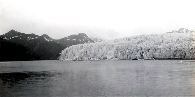
Image 1: Muir Glacier, Alaska, 2004. Blue water in foreground, glacier in background, large amount of rock exposed. Are glaciers changing? Yes. Over the last century, and over the last few decades, essentially every glacier on the planet has gotten smaller. Over shorter times, the “fun things” glaciers do (surges, kinematic waves, etc.) have caused some to grow while others shrank, but overall shrinkage is strong. Here are some photo pairs, historical and more recent, assembled by Bruce Molnia of the United States Geological Survey, and archived at the National Snow and Ice Data Center. The lenses used are not always identical, but the photos are taken as nearly as possible from the same spot, and you should be able to see the changes clearly.
Image 2: Muir Glacier, Alaska in 1941. Glacier covers most of photo, no water visible. Muir Glacier, Alaska, August 13, 1941, photo by B.F. Molnia
Image 3: Muir Glacier, Alaska, 2004. Blue water in foreground, glacier in background, large amount of rock exposed. Muir Glacier, Alaska, August 31, 2004, photo by W.O. Field
Image 4: Holgate Glacier, AK, 1909. Glacier covers much of rock, water in foreground. Holgate Glacier, AK, July 24, 1909, photo by U.S. Grant
Image 5: Holgate, AK, 2004. Small amount of glacier visible, large portions of rock exposed, water in foreground. Holgate Glacier, AK, Aug. 13, 2004, photo by B.F. Molnia
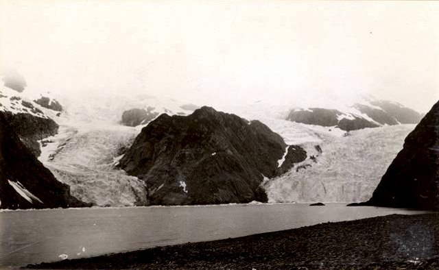
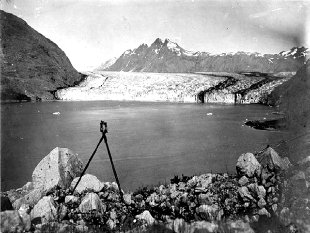
Image 6: McCarty Glacier, AK, 1909. Large glacier in center, water in foreground, mountain visible to left in background. McCarty Glacier, AK, July 30, 1909, photo by U.S. Grant
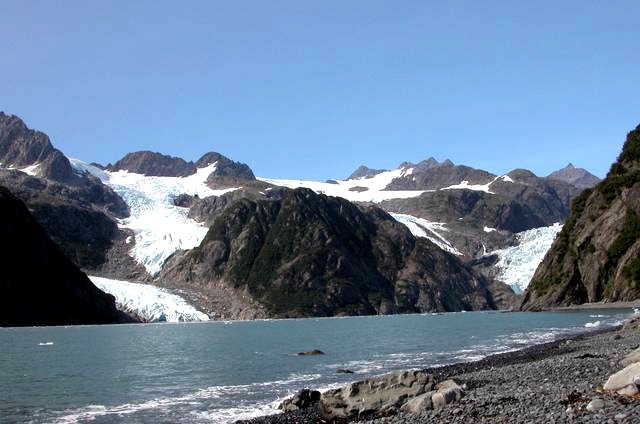
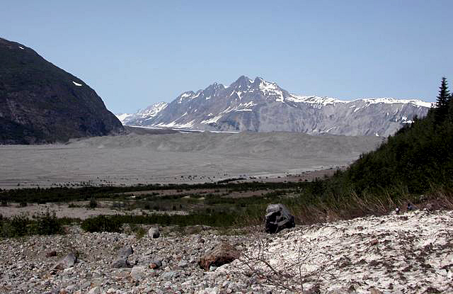
Image 7: McCarty Glacier, AK, 2004. No glacier visible. Water in foreground, mountains in background. McCarty Glacier, AK, Aug. 11, 2004, photo by B.F. Molnia
Image 8: McCarty Glacier, AK, 1906. Rocky water’s edge and water in foreground. Glacier in background, in front of snow capped mountains. McCarty Glacier, AK, Aug. ??, 1906, photo by C.W. Wright
Image 9: McCarty Glacier, AK, 2004. Rocks in foreground, no water, melting glacier in background in front of snow capped mountains. McCarty Glacier, AK, June 21, 2004, photo by B.F. Molnia