
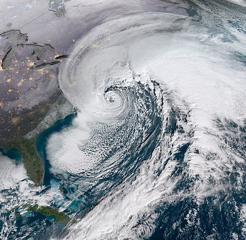
The Historic “Bomb Cyclone” of January 2018
In January 2018 a particularly intense nor’easter impacted the northeastern United States, bringing a freezing storm surge ashore in cities such as Boston. Although this was a rare set of circumstances, storms like this are not uncommon.
The storm originated on January 3rd as an area of low pressure off the coast of the southeastern U.S., which traveled rapidly up the eastern seaboard. The storm explosively deepened during this period, earning the storm its memorable moniker of “Bomb Cyclone.” The storm was also given other unofficial names, such as Winter Storm Grayson, Blizzard of 2018, and Storm Brody.
The term bomb cyclone comes from meteorological terms describing an extreme drop in the central pressure of the storm. Terms including explosive cyclogenesis, weather bomb, meteorological bomb, bomb cyclone, and bombogenesis were used to describe the rapid deepening of the low-pressure area of the extratropical cyclone.
By the morning of January 4, the powerful storm system had deepened by 53 mbar of pressure in 21 hours—one of the fastest rates ever observed in the Western Atlantic (Wikipedia). This drop in pressure was over twice the threshold (24 mbar in 24 hours) for bombogenesis.
In Massachusetts, winds gusted to hurricane-force at 76 miles per hour (122 km/h) on Nantucket Island. At least 17.0 inches (430 mm) of snow fell on Boston. In Boston, a freezing storm tide of 15.16 ft (4.62 m) was recorded during the blizzard which flooded areas of the financial district, including a subway station, setting a new historical record. Significant coastal flooding occurred in Maine and New Hampshire.
For more information
- Washington Post Video: Storm surge floods coastal towns in Massachusetts
- Business Insider: Bomb Cyclone Imagery