Try This!
DigitalGlobe began as WorldView Imaging Corporation, one of several companies founded inanticipation of the 1992 Land Remote Sensing Policy Act, which created thecommercialsatellite imaging business in the U.S. Another startup was ORBIMAGE, which was renamed GeoEye after acquiring Space Imaging Corporation. DigitalGlobe became theworld’s largest commercial provider of earth imaging products after it acquired GeoEye in 2013.This site visit is meant to acquaint you with with the kinds of sensors, data products and services a provider like DigitalGlobe offers.
The instructions below are based on the October 2015 version of the website. Please bear in mind that websites change without notice.
1. First, go to DigitalGlobe’s home page and scroll to the bottom, where you’ll find a list of CONTENT.
Follow links in that list to explore DigitalGlobe’s various products and services, including Imagery, Elevation, and Human Landscape.

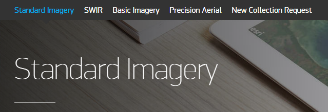
2. In the list of CONTENT, follow the Imagery Suitelink and explore DigitalGlobe’s imagery products, including Basic Imagery, Standard Imagery, Precision Aerial, and New Collection Request. The latter allows satellite tasking requests to be made.
4. Near the bottom of each Imagery product page you should find a link to a Datasheet. Click the link to view the datasheet. (It will open in a new window or tab.)

5. Study the data sheets with a few questions in mind: What’s the difference between “Basic” and “Standard” imagery? Which sensing systemscontribute to each imagery product? Which image bands are available? What information about spatial (pixel) and radiometric resolution are provided?

6. Next, let’s see whatimagery products are available for your area of interest.Go back to the main page and scroll all the way to the bottom again and follow the Quick Link to Search Imagery.

Following the Search Imagery link will open the ImageFinder tool. As of this writing, it looked like the image below.
7. Enter a place name in the Go To: field to search the gazetteer. I was interested in chose Perth, Australia, but I just typed Perth into the field.
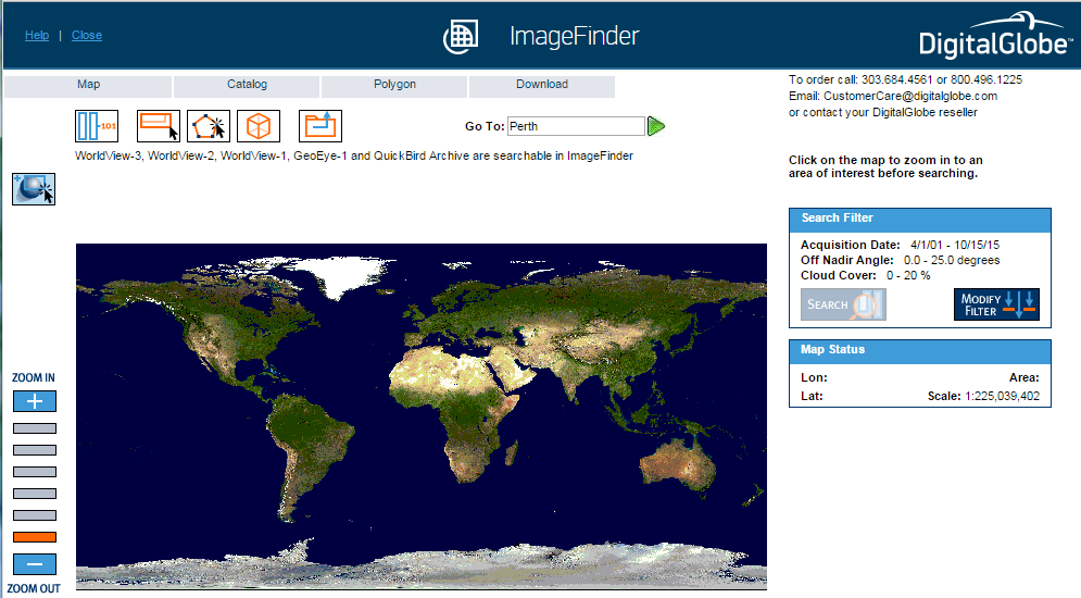
8. Next, click the green “Go to this location” arrow head. That will open the ImageFinder Gazetteer window, showing in my case a list of locations in the world named Perth.

8. In the Gazetteer list I clicked on the first entry, for Perth, Australia. The Gazetteer window closes and the map zooms to the vicinity of Perth, Australia.

9. Next, in the Search Filter box to the right of the map, click Search to query for imagery tracks that intersect the map bounding box.
Wait for it... eventually you should get a new Catalog window that lists the imagery available for your selected area. Here’s what I got:
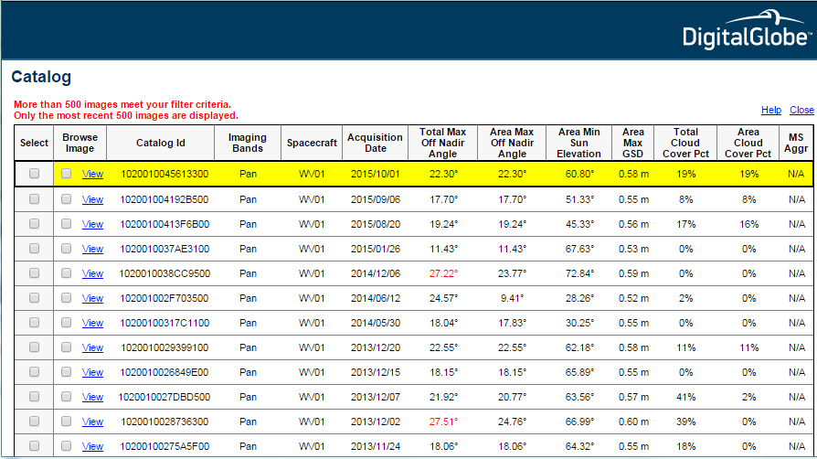
In the Catalog list above, notice the variety of spacecraft (sensor “vehicles”), bands, dates, andmaximum spatial resolution (Ground Sample Distance). Why do you suppose a maximum is given, rather than a single GSD value?
10. Clicking on an entry in the Catalog list turns it yellow and also highlights the area on the map covered by the selected image.

11. Finally, here’s what I received after clicking to View the most recent image listed.
You can zoom in or out by choosing from the Image Resize pick list.

Maybe you’re wondering how much you’d have to pay to acquire that scene? You won’t find prices on DigitalGlobe’s web site. However, we were able to find a bootleg copy of DigitalGlobe’s price book with a simple web search. Or of course you can contact DigitalGlobe or an authorized reseller.
That’s it for our site visit. Hope you enjoyed it.