Prioritize...
At the end of this section, you should be able to distinguish between geostationary and polar-orbiting satellites. You should also be able to describe their differences and roles in observing the earth, and be able to identify a satellite image as being collected by a geostationary satellite or a polar-orbiting satellite.
Read...
Today, meteorologists have an ever-increasing number of sophisticated, computerized tools for weather analysis and forecasting. But, before 1960, meteorologists drew all their weather maps by hand and no useful computer models existed. Seems like the dark ages, right? Furthermore, before 1960, forecasters did not have weather satellites to afford them a birds-eye view of cloud patterns. The dark ages ended after NASA launched Tiros-I on April 1, 1960.
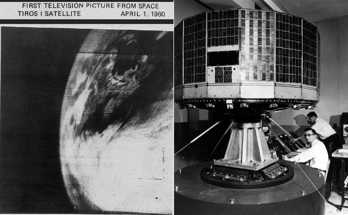
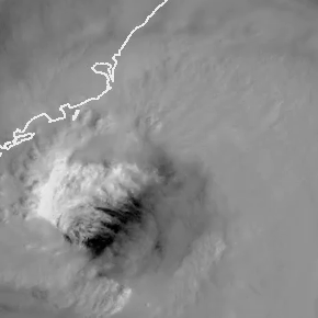
Though the unrefined, fuzzy appearance of this image may seem crude and almost prehistoric, it was an eye-opener for weather forecasters, paving the way for new discoveries in meteorology (not to mention improved forecasts). Today, satellite imagery with high spatial resolution allows meteorologists to see fine details in cloud structures. For example, check out this close-up loop of the eye of Hurricane Dorian in 2019 (loop credit: Dakota Smith). We've come a long way, wouldn't you agree?
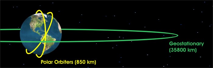
Two types of flagships exist in the select fleet of weather satellites that routinely beam back images of Earth and the atmosphere -- geostationary satellites and polar-orbiting satellites.
Geostationary Satellites
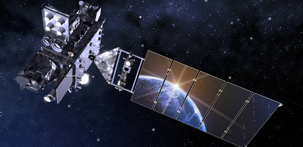
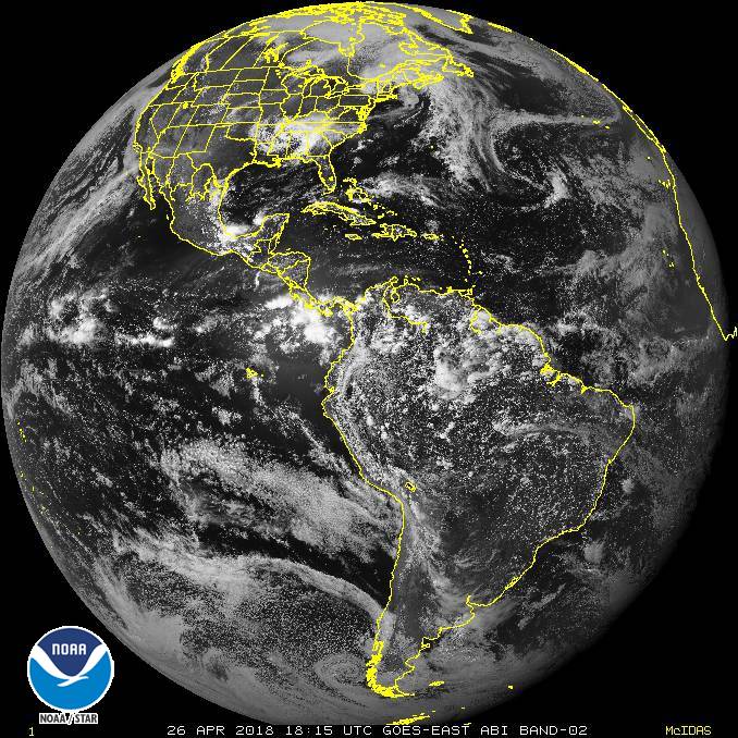
Geostationary satellites orbit approximately 35,785 kilometers (22,236 miles) above the equator, completing one orbit every 24 hours. Thus, their orbit is synchronized with the rotation of the Earth about its axis, essentially fixing their position above the same point on the equator (hence the name "geostationary"). In the United States, the National Oceanic and Atmospheric Administration's (NOAA) geostationary satellites go by the name of "GOES" (Geostationary Operational Environmental Satellite) followed by a number. To get an idea of what a geostationary satellite looks like, check out the artist's rendering of GOES-16 on the right.
Two operational GOES satellites currently orbit over the equator at 75 and 135 degrees west longitude, respectively. The terms "GOES East" and "GOES West" are the generic terms for the operational satellites stationed at those longitudes. GOES-East is in a good spot to keenly observe Atlantic hurricanes as well as weather systems over the eastern half of the United States. GOES-West is in better position to observe the eastern Pacific and the western half of the United States. If you are interested in learning more about the current condition of any particular GOES satellite, you can check out the GOES Spacecraft Status page run by the NOAA's Office of Satellite Operations.
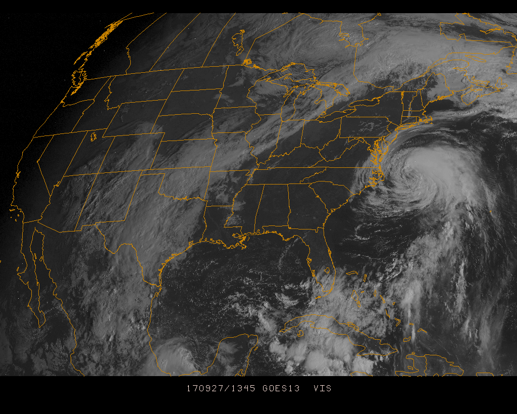
From their extremely high vantage point in space, GOES-East and GOES-West can effectively scan about one-third of the Earth's surface. Their broad, fixed views of North America and adjacent oceans make our fleet of geostationary satellites very effective tools for operational weather forecasters, providing constant surveillance of atmospheric "triggers" that can spark thunderstorms, flash floods, snowstorms and hurricanes (among other things). Once threatening conditions develop, the broad, fixed view of geostationary satellites is especially handy because we can create loops of geostationary satellite imagery, which allow forecasters to monitor the paths and intensities of storms. For example, this loop of GOES satellite images spans from 1345Z to 1745Z on September 27, 2017, and shows Hurricane Maria spinning just off the East Coast.
Geostationary satellites are far from perfect, however. Geostationary satellites don't have a very good view of high latitudes because they're centered over the equator. Therefore, clouds at high latitudes become highly distorted and at latitudes poleward of approximately 70 degrees, geostationary satellites become essentially useless.
I don't want to leave you with the impression that the GOES program is unique, however. Other countries also own and operate geostationary weather satellites (here's an international perspective on geostationary weather satellites if you're interested). If you want to access images from GOES or geostationary weather satellites operated by other countries, surf to the University of Wisconsin's website, or try NOAA's GOES Satellite Server.
Summary: Geostationary satellites provide fixed views of large areas of the earth's surface (a large portion of an entire hemisphere, for example). The fact that their view is fixed over the same point on earth means that sequences of their images can be created to help forecasters track the movement and intensity of weather systems. The primary limitation of geostationary satellites is that they have a poor viewing angle for high latitudes and are essentially useless poleward of 70 degrees latitude.
Polar-Orbiting Satellites
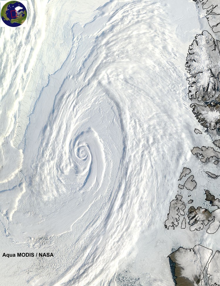
Polar-orbiting satellites pick up the high-latitude slack left by geostationary satellites. In the figure below, note that the track of a polar orbiter runs nearly north-south above the earth and passes close to both poles, allowing these satellites to observe, for example, large polar storms and large Antarctic icebergs. Polar-orbiting satellites orbit at an average altitude of 850 kilometers (about 500 miles), which is considerably lower than geostationary satellites.
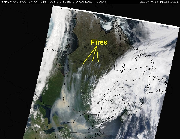
Each polar orbiter has a track that is essentially fixed in space, and completes 14 orbits every day while Earth rotates beneath it. So, polar orbiters get a worldly view, but not all at once! Like making back-and-forth passes while mowing the lawn, these low-flying satellites scan the Earth in swaths about 2600 kilometers (1600 miles) wide, covering the entire earth twice every 24 hours. The appearance of a "lawn-mowing-like" swath against a data-void, dark background on a satellite image is a dead give-away that it came from a polar orbiter, as illustrated by this visible image of smoke sweeping over the Northeast States from fires in Quebec in early July 2002.
NOAA designates its polar orbiters with the acronym "POES" (Polar Orbiting Environmental Satellite) followed by a number. NOAA currently classifies the newest satellite as its "operational" polar orbiter, while slightly older satellites that continue to transmit data are classified as "secondary" or "backup" satellites. As a counterpart to the GOES satellites, the NOAA Office of Satellite Operations operates a POES Spacecraft Status page as well. NASA and the Department of Defense also operate polar orbiters.
Summary: Polar-orbiting satellites orbit at a much lower altitude than geostationary satellites, and don't have a fixed view since the earth rotates beneath their paths. The benefit of polar-orbiters is that they can give us highly-detailed images, even at high latitudes. The main drawback is that they have a limited scanning width, and don't provide continuous coverage for any given area (like geostationary satellites do). A single image from a polar orbiter will often show a swath with sharply defined edges that mark the boundaries of what the satellite could see on a particular pass.
Data from satellites has truly revolutionized weather analysis and forecasting. Satellites can measure atmospheric temperatures, moisture, and winds, among other things. Roughly 80 percent of all data used to run computer forecast models comes from polar orbiting satellites alone, so satellites are a critical part of weather forecast operations around the globe! Now that you have some background about the different types of satellites providing crucial weather data, we'll soon turn our attention to interpreting some main types of satellite images. First, however, we're going to examine some basic cloud types, which will help us in our discussion about interpreting satellite images.