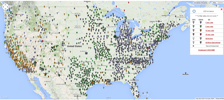
NGS Continuously Operating Reference Stations
The NGS CORS network is illustrated here. It includes hundreds of stations constantly logging GPS/GNSS data. The establishment of a CORS network, the result, has been a boon for high-accuracy GPS/GNSS positioning. Surveyors in the United States can take advantage of the CORS network administered by the National Geodetic Survey, NGS. The continental NGS system has two components, the Cooperative CORS and the National CORS. NGS manages the national CORS to support this post-processing for both code and carrier phase observations. The Cooperative CORS system supplements the National CORS system. The NGS does not directly provide the data from the cooperative system of stations. Its stations are managed by participating university, public, and private organizations that operate the sites. These cooperative arrangements mean that we all can use the data free on charge in most cases. That data can then be conveniently downloaded in its original form from the Internet free of charge for up to 30 days after its collection. It is also available later, but after it has been decimated to a 30-second format. The data is available in the Receiver Independent Exchange Format, or RINEX format. The RINEX format allows you to use any type of a receiver to log your data because this RINEX format is available from virtually every kind of standard GPS/GNSS receiver.
Nearly all coordinates provided by NGS for the CORS sites are available in NAD83 (2011) epoch 2010.0. The coordinates of CORS stations are also published in ITRF2014 (2010.0). These positions differ from NAD83(2011). All the coordinates are accompanied by velocities since the stations are moving. These velocities can be used to calculate the stations position at a different date using NGS’s Horizontal Time Dependent Positioning (HTDP) utility.
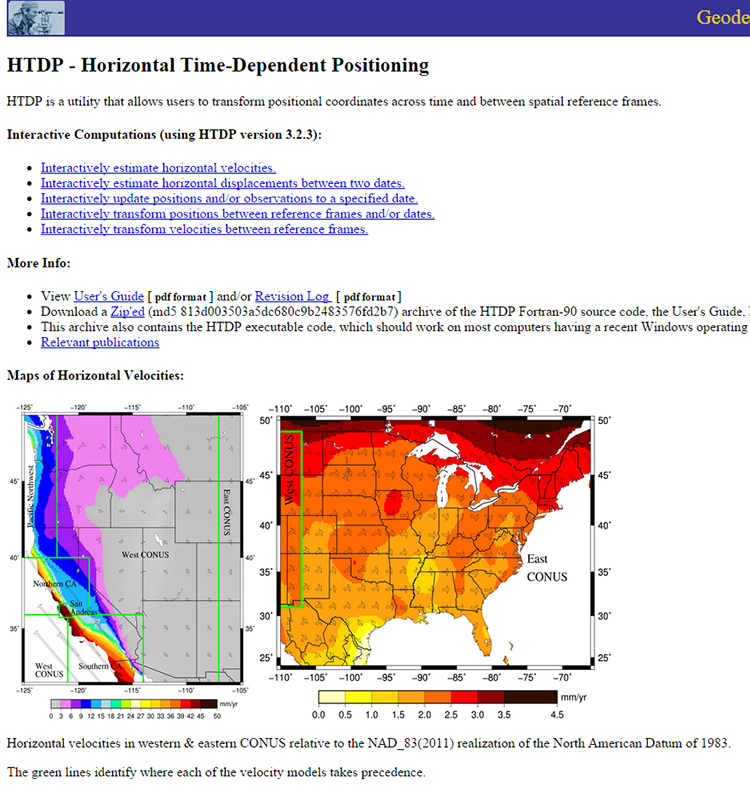
Here (above) is an illustration of the Horizontal Time-Dependent Positioning website.
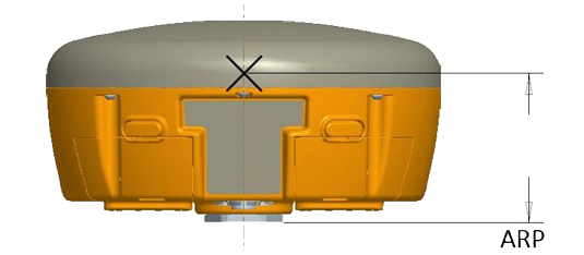
At a CORS site, NGS provides the coordinates of the L1 phase center and the Antenna Reference Point (ARP). Generally speaking, it is best to adopt the position that can be physically measured, that means the coordinates given for the ARP. It is the coordinate of the part of the antenna from which the phase center offsets are calculated that is usually the bottom mount. The phase centers of antennas are not immovable points. They actually change slightly, mostly as the elevation of the satellite’s signals change. In any case, the phase centers for L1, L2 and L5 differ from the position of the ARP both vertically and horizontally. NGS provides the position of the phase center on average at a particular CORS site. As most postprocessing software will, given the ARP, provide the correction for the phase center of an antenna, based on antenna type, the ARP is the most convenient coordinate value to use. The distance to the ARP is often given from the bottom of the mount, as indicated by this diagram.
International GNSS Service (IGS)
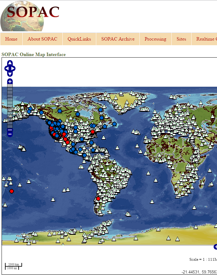
Like NGS, IGS also provides CORS data. However, it has a global scope. The information on the individual stations can be accessed, including the ITRF Cartesian coordinates and velocities for the IGS sites, but not all the sites are available from IGS servers. The Scripps Orbit and Permanent Array Center (SOPAC) is a convenient access point for IGS data. A virtual map of the available GPS/GNSS networks can be found there.
Tracking data is from international networks. Here you see a graphic of its extent. It's virtually worldwide. You can download the tracking information from these antennas, these known positions, to post-process the data from a roving GPS/GNSS antenna internationally.
The Scripps Orbit and Permanent Array Center
SOPAC is a convenient access point for IGS data.