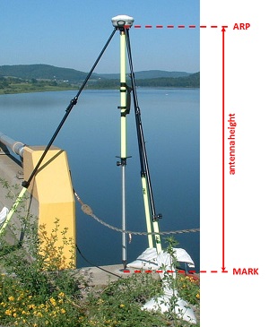
The care ascribed to the measurement of antenna heights is due to the same concern applied to centering. GPS/GNSS has an extraordinary capability to achieve accurate ellipsoidal heights, but those heights can be easily contaminated by incorrect H.I.s.
Most GPS/GNSS receivers capable of geodetic accuracy are designed to be mounted on a tripod, usually with a tribrach and adaptor. However, there is a trend toward bipod- or range-pole-mounted antennas. An advantage of these devices is that they ensure a constant height of the antenna above the station. The mismeasured height of the antenna above the mark is probably the most pervasive and frequent blunder in GPS/GNSS control surveying. The tape or rod used to measure the height of the antenna is sometimes built into the receiver and sometimes a separate device. It is important that the height of the instrument (H.I.) be measured accurately and consistently in both feet and meters, without merely converting from one to the other mathematically. It is also important that the value be recorded in the field notes and, where possible, also entered into the receiver itself. Since many systems measure the height of the antenna to the edge of the ground plane or to the exterior of the receiver itself, the calibration of the tribrach affects both the centering and the H.I. measurement. The resetting of a receiver that occupies the same station in consecutive sessions is an important source of redundancy for many kinds of GPS/GNSS networks. However, integrity can only be added if the tribrach has been accurately calibrated.
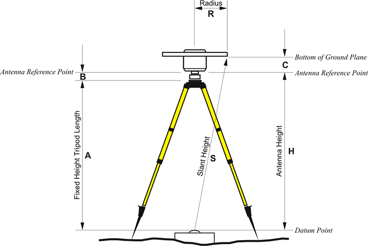
The measurement of the height of the antenna in a GPS/GNSS survey is often not made on a plumb line. A tape is frequently stretched from the top of the station monument to some reference mark on the antenna or the receiver itself. Some GPS/GNSS teams measure and record the height of the antenna to more than one reference mark on the ground plane. These measurements are usually mathematically corrected to plumb.