Using a Processing Service
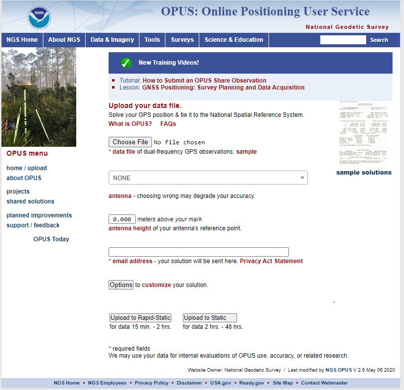
An alternative to in-house post-processing is the use of a processing service. There are several services available to GPS/GNSS surveyors. While they differ somewhat in their requirements, they are all based on the same idea. Static GPS/GNSS data collected in the field may be uploaded to a website on the Internet by the hosting organization, which will then return the final positions, often free of charge. Usually, the user is directed to an ftp site where the results can be downloaded. There can be advantages to the use of such a processing service. Aside from removing the necessity of having post-processing software in-house, there is the strength of the network solution available from them. In other words, rather than the data sent in by the GPS/GNSS surveyor being processed against a single CORS in the vicinity of the work, it is processed against a group of the nearest CORS. There are often three in the group. Such a network-based solution improves the integrity of the final position markedly and may compensate for long baselines required by the sparseness of the CORS in the area of interest. Among the online resources available for processing services is the National Geodetic Survey's Online Positioning User Service (OPUS). This service allows the user to submit RINEX files through NGS' Web page. They are processed automatically with NGS computers and software utilizing data from three CORS that may be user selected. There are others, such as the Australian Online GPS Processing Service, AUSPOS.