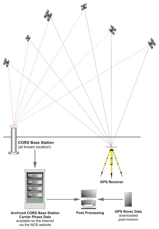
So, here are the fundamental ideas that underlie the static GPS/GNSS surveying technique. The first receiver, the base, provides the data to compute the differences between its known position and the unknown positions measured at the second, or roving receiver. Static GPS/GNSS requires post-processing and is used for establishing control by GPS/GNSS. While correlated systematic errors can be virtually eliminated with differential correction, the biases such as multipath and receiver channel noise are certainly not. These errors have been much reduced in modern GPS/GNSS receivers, but not completely defeated. Biases such as high PDOP can only be resolved with both good receiver design and care as to when and where the surveying is done.
In the next lesson, we delve into real-time GPS/GNSS work and Precise Point Positioning.
Before you go on to Lesson 8, double-check the Lesson 7 Checklist to make sure you have completed all of the activities listed there.